
Description
Engraving on hand laid paper. on paper.
Size in cm: The overall size is ca. 72.8 x 53.5 cm. The image size is ca. 69.9 x 51.7 cm. Size in inch: The overall size is ca. 28.7 x 21.1 inch. The image size is ca. 27.5 x 20.4 inch.
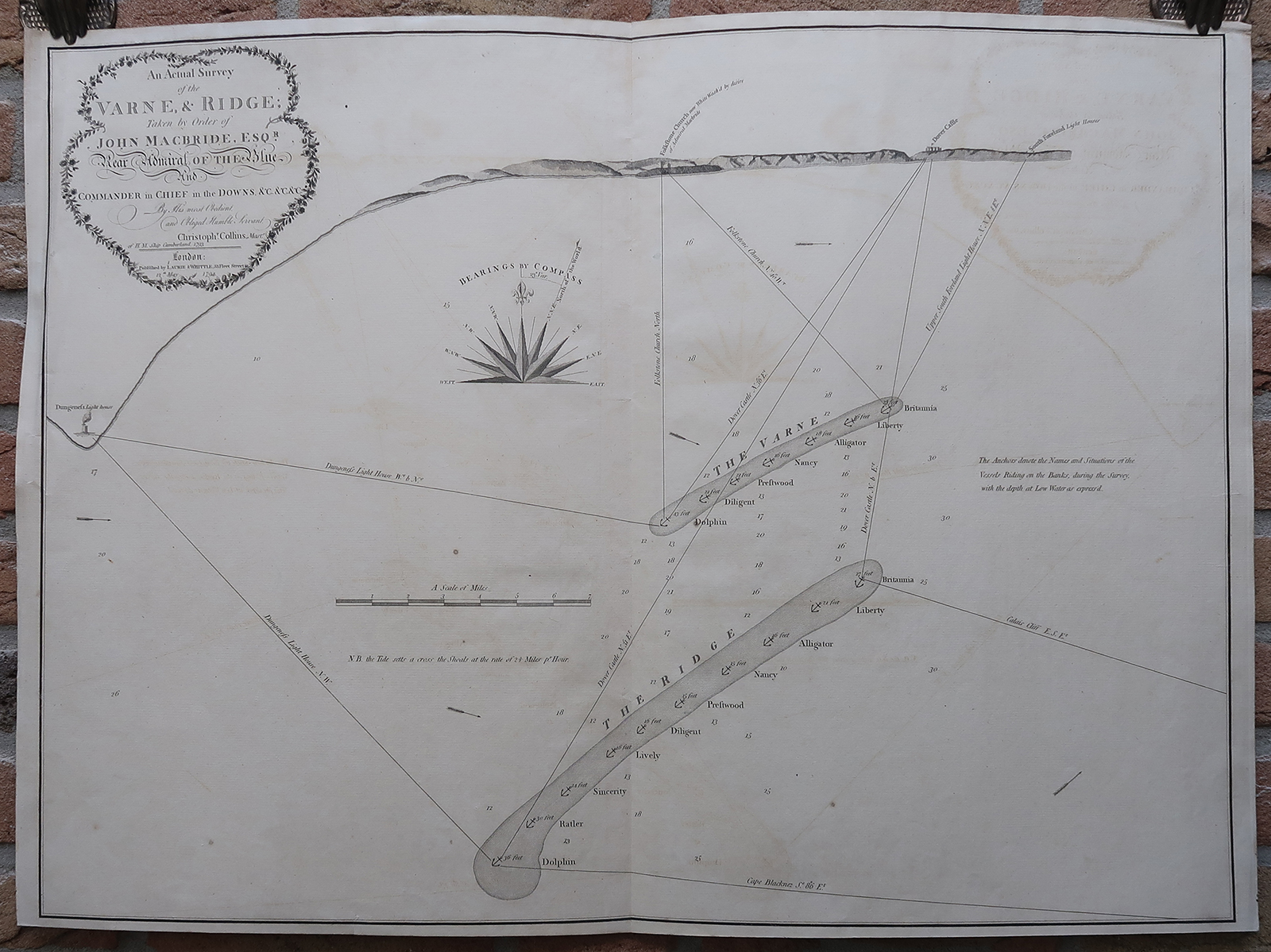
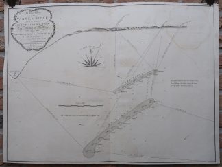
Antique map, titled: ”An Actual Survey of the Varne, & Ridge […].” – A curious sea chart of the two major sand banks (Varne Bank and the Colbart Bank, also known as The Ridge) in the Strait of Dover, off the coast between Dungeness and Dover. Instead of the regular map view, the coast is depicted with profiles. Depth soundings near the sand banks, and a compass rose. Published by Robert Laurie & James Whittle, London, 1794.Artists and Engravers: Made by an anonymous engraver after ‘Christopher Collins’.
Condition: Very good, given age. Original middle fold, as issued. Some faint offsetting where the map was folded on itself. A small tear in the lower margin. Some creasing in the top and left edges of the sheet. A few small scattered stains in the image area. General age-related toning and/or occasional minor defects from handling. Please study scan carefully.
Keywords: ANTIQUE MAP-SEA CHART-STRAIT OF DOVER-DUNGENESS-COLBART-LAURIE & WHITTLE
(PCO) GK-181
![Antique Print - Pantheon - Athens - Greece [Poppel, c.1860]](https://pictura-prints.com/wp-content/uploads/2019/08/pco-8315-324x232.jpg)


Reviews
There are no reviews yet.