
Description
Engraving with contemporary hand colouring on hand laid (verge) paper. on paper.
Size in cm: The overall size is ca. 64.5 x 54 cm. The image size is ca. 60.5 x 51.5 cm. Size in inch: The overall size is ca. 25.4 x 21.3 inch. The image size is ca. 23.8 x 20.3 inch.
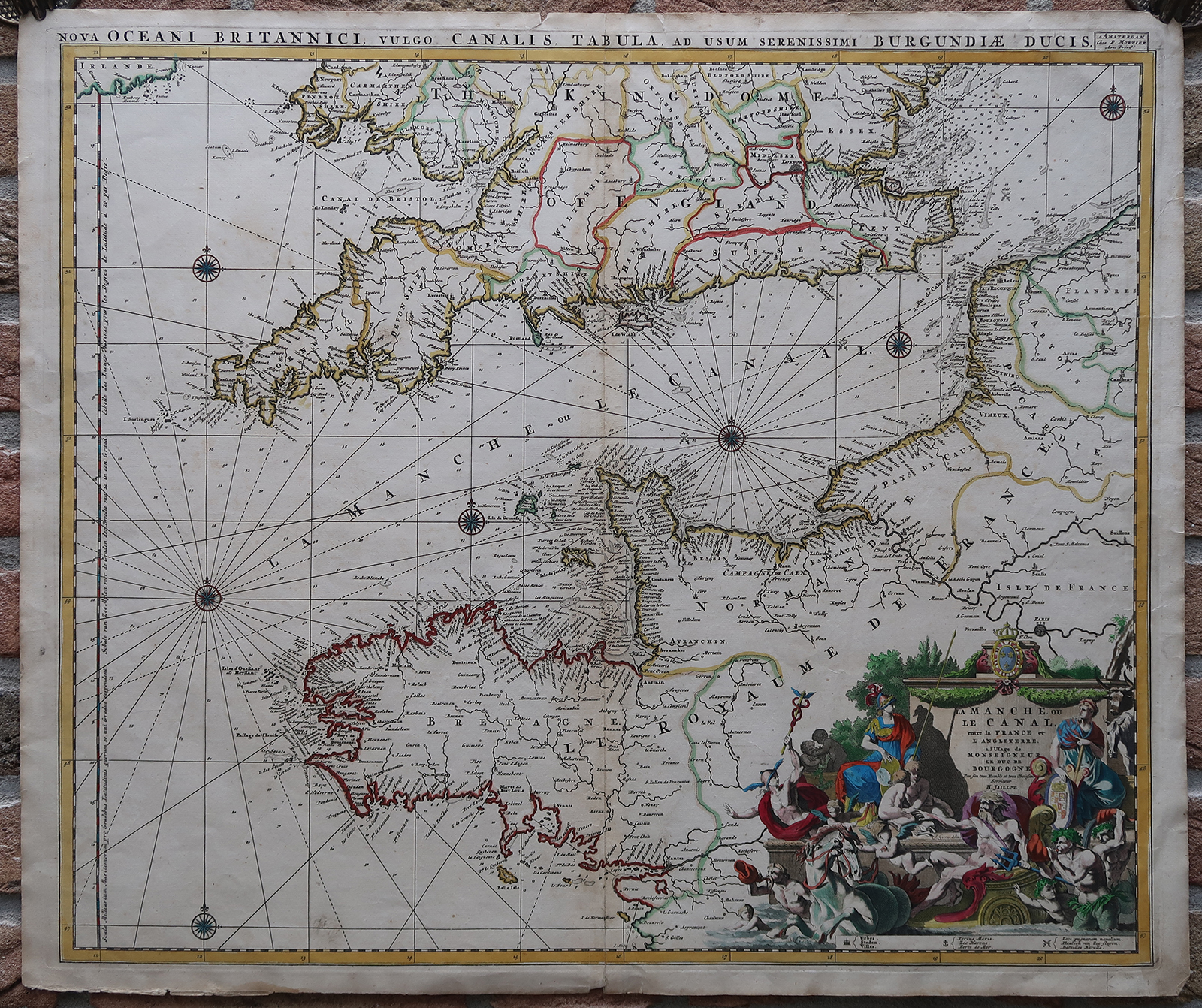
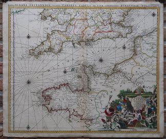
Antique map, titled: ‘La Manche ou le Canal, entre la France et l’Angleterre.’ – A very attractive map of the Channel between England and France, and showing copious portions of both these countries. With a large decorative cartouche in the lower right. The locations of major sea battles are depicted, as well as depth soundings and a plethora of islands and coastal towns. Published by P. Mortier, Amsterdam.Artists and Engravers: Made by an anonymous engraver after ‘H. Jaillot’. Alexis-Hubert Jaillot (1632-1712), was a French cartographer. Through his marriage he inherited a map and print publishing firm. When Nicolas Sanson, the premier French cartographer of his days, died Jaillot negotiated to republish much of his work. Jailliot was succeed by his son, Bernard Jean Hyacinthe Jaillot (1673-1739), grandson, Bernard Antoine Jaillot (died 1749) and the latter’s brother-in-law, Jean Baptiste-Michel Renou de Chauvigne-Jaillot (1710-1780). Publisher: Pieter / Pierre Mortier (1661-1711). Pieter and David Mortier were booksellers in Paris from 1681-1685 and have published a wide range of geographical works.
Condition: Very good, given age. Original middle fold (as issued). The margin edges with several small tears and dampstaining. Faintly browned in the middle fold. General age-related toning and/or occasional minor defects from handling. Please study scan carefully.
Keywords: ANTIQUE MAP-CHANNEL-ENGLAND-FRANCE-SEA CHART-JAILLOT
(PCO) GK-247


Reviews
There are no reviews yet.