
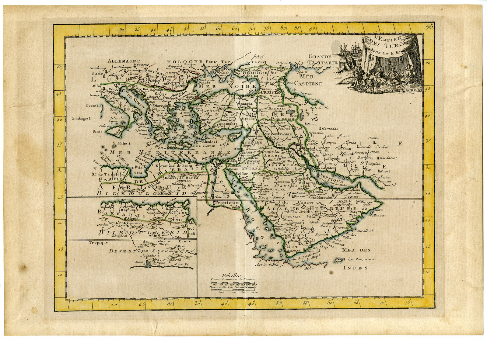
Description
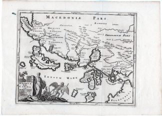
Medium: Copper engraving with original outline hand-coloring on hand laid (verge) paper.
Sheet size: 34.3 x 23.8 cm (13.5 x 9.37 inch). Image size: 27.3 x 20.7 cm. (10.75 x 8.15 inch).
Condition: very good, given age. Original middle fold as issued. Light foxing, creasing and soiling. Ghosting from previous framing. Paper tape on rear paper edges. General age-related toning and/or occasional minor defects from handling. Please study scan carefully.
OTTOMAN EMPIRE, HISTORICAL MAP, LE ROUGE, 18TH-CENTURY MAPS, PARIS MAPMAKERS, TURKISH EMPIRE, ANTIQUE CARTOGRAPHY, MAGHREB, MIDDLE EAST, FRANCE, ATLAS NOUVEAU PORTATIF | PCO-E19-46
BACKGROUND INFORMATION
From “Atlas Nouveau Portatif a l’usage des militaires et du voyageur” by Le Rouge, Paris, 1756.
Biography engraver: Georges-Louis Le Rouge (c.1712 – c.1790) was an eighteenth-century cartographer, engraver and architect, geographer engineer to King Louis XV, author of atlases, maps, battle plans and relevance of strongholds. His career and social connections, straddling Germany and France, are characteristic of the geographical engineers of his time, who travelled throughout eighteenth-century Europe to acquire and then demonstrate their cartographic skills.


Reviews
There are no reviews yet.