
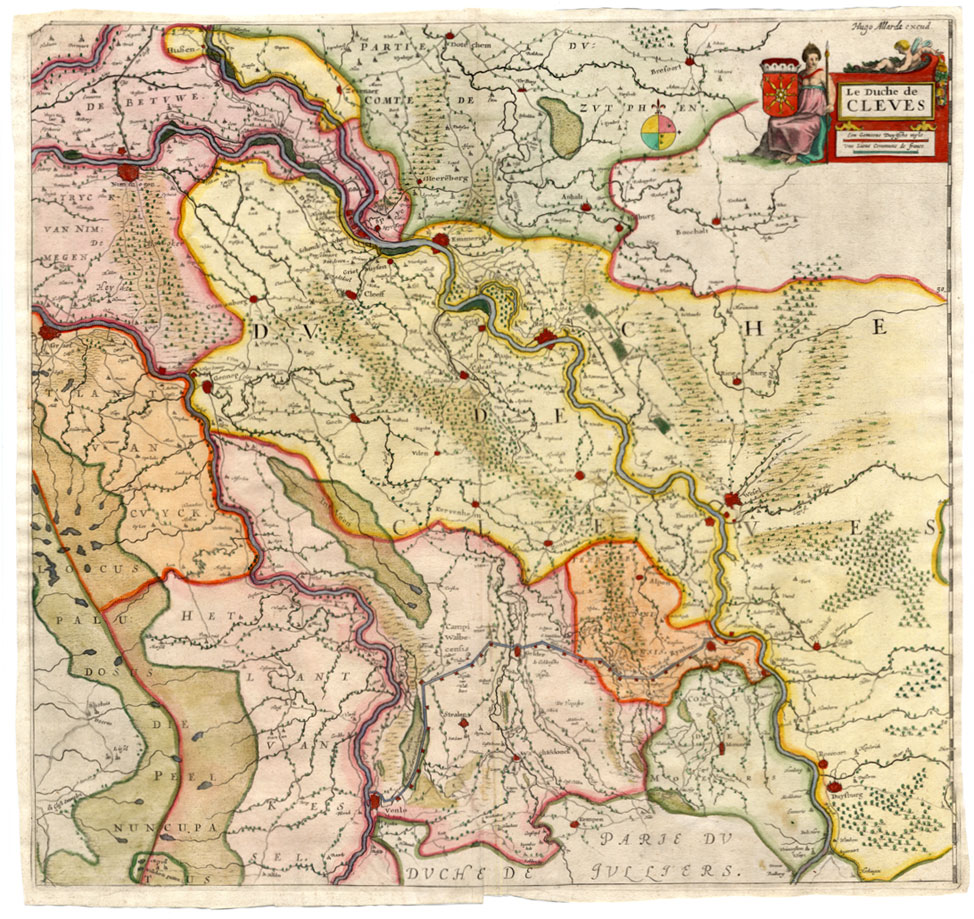
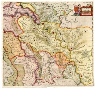
Description
Copperplate engraving on verge type hand laid paper with watermark. Original recent hand colouring. on paper.
Size in cm: The overall size is ca. 50 x 48 cm. The image size is ca. 49 x 46 cm. Size in inch: The overall size is ca. 19.7 x 18.9 inch. The image size is ca. 19.3 x 18.1 inch.
Map : ‘ Le Duche de Cleves’. (Map of the Duchy of Cleves.) Rare map of the Duchy of Cleves in Germany by Hugo Allardt. Published in amsterdam ca. 1660 by Hugo Allardt.Artists and Engravers: Huych (or Hugo) Allard (or Allardt) (1625-1691) was an engraver and the founder of the Allard publishing business in Amsterdam. He was succeeded in the business by his son Carel (1648-c.1706) and by Carel’s sons in turn – Hugo the younger and Abraham.
Condition: Excellent. general age related toning. some light staining from handling. Tear near bottom middle fold backed.
Keywords: RARE ANTIQUE MAP-KLEVE-CLIVIA-GERMANY-ALLARDT
XXX-B3-03


![NEW GUINEA-AQUATIC PLANTS [Jan LAMSVELT after DAMPIER, 1771]](https://pictura-prints.com/wp-content/uploads/2019/01/pc-2454-324x440.jpg)

Reviews
There are no reviews yet.