
![Manuscript Atlas Joséphine Simon, Manuscript Atlas Joséphine Simon [19 maps, mid/late 18th c.], Pictura Antique Prints](https://pictura-prints.com/wp-content/uploads/2018/10/book52d.jpg)
![Manuscript Atlas Joséphine Simon, Manuscript Atlas Joséphine Simon [19 maps, mid/late 18th c.], Pictura Antique Prints](https://pictura-prints.com/wp-content/uploads/2018/10/book52c.jpg)
![Manuscript Atlas Joséphine Simon, Manuscript Atlas Joséphine Simon [19 maps, mid/late 18th c.], Pictura Antique Prints](https://pictura-prints.com/wp-content/uploads/2018/10/book52e.jpg)
![Manuscript Atlas Joséphine Simon, Manuscript Atlas Joséphine Simon [19 maps, mid/late 18th c.], Pictura Antique Prints](https://pictura-prints.com/wp-content/uploads/2018/10/book52a.jpg)
Description
Large format manuscript atlas Joséphine Simon, consisting of 19 double-page folio maps in ink on hand laid paper, handcoloured in watercolour. Some details in pencil.
Folio, paper spine over marbled boards.
Maps include: Mappemonde, Carte d’Europe, Carte d’Asie, Carte d’Afrique, Amérique Septentrionale, Amérique Méridionale, Carte de l’Oceanie, Carte de France, Carte d’Italie, Carte de Pays-Bas, Carte d’Espagne, Carte de Suisse, Carte d’Allemagne, Carte del Iles Brittaniques, Carte de la Turquie, Carte de la Russie, Carte de la Norvège, Départemen de Vosgee, Carte de la Palestine ou Terre Sainté. Total 19 maps.
Part of the maps signed Josephine S. or Josephine Simon. We have not been able to trace Josephine Simon. Given the style of the atlas, we think this is a mid to late 18th century production.
Binding in fair condition: damage to the spine ends, exposing the binding partly. Board edges and spine rubbed and a little worn.
Inside in good condition: a dampstain in the lower margin of the maps (not affecting map area), margins of the maps a little soiled. Ink and watercolours on the maps caused offsetting on the opposite side of the page. A few scattered small stains.
Similar items are these two manuscript maps of Indonesia:
Java, by J. Ameshoff.
“Oost-Indië” (Dutch East India), by B. Ameshoff.

![[SEPP and NOZEMAN] Motacilla Luscinia (Nightingale)](https://pictura-prints.com/wp-content/uploads/2018/07/pcorc075-324x457.jpg)

![GREATER WHITE FRONTED GOOSE-ANSER ALBIFRONS 'Anas Erythropus' [SEPP and NOZEMAN, 1770]](https://pictura-prints.com/wp-content/uploads/2018/07/pcorc134-324x226.jpg)
![[Barlus BARLUS] A mon ami …](https://pictura-prints.com/wp-content/uploads/2018/07/pco_0858-324x415.jpg)

![RED PHALAROPE-GREY-PHALAROPUS FULICARIUS 'Phalaropus platyrhinchus' [SEPP and NOZEMAN, 1770]](https://pictura-prints.com/wp-content/uploads/2018/07/pcorc329-324x225.jpg)
![[SEPP and NOZEMAN] Lanius excubitor (Great Grey Shrike)](https://pictura-prints.com/wp-content/uploads/2018/07/pcorc074-324x457.jpg)


![GREATER SCAUP-AYTHYA MARILA-DUCK 'Anas marila' [SEPP and NOZEMAN, 1770]](https://pictura-prints.com/wp-content/uploads/2018/07/pcorc179-324x459.jpg)
![COMMON GREENSHANK-TRINGA NEBULARIA 'Tringa ochropus' [SEPP and NOZEMAN, 1770]](https://pictura-prints.com/wp-content/uploads/2018/07/pcorc217-324x457.jpg)

![[SEPP and NOZEMAN] Fringilla Domestica (Sparrow)](https://pictura-prints.com/wp-content/uploads/2018/07/pcorc051-324x457.jpg)
![[SEPP and NOZEMAN] Hirundo domestica (Barn Swallow)](https://pictura-prints.com/wp-content/uploads/2018/07/pcorc025-324x457.jpg)
![GREYLAG GOOSE-ANSER ANSER 'Anas Anser' [SEPP and NOZEMAN, 1770]](https://pictura-prints.com/wp-content/uploads/2018/07/pcorc130-324x225.jpg)


![ALCA TORDA-RAZORBILL 'Alca torda' [SEPP and NOZEMAN, 1770]](https://pictura-prints.com/wp-content/uploads/2018/07/pcorc274-324x457.jpg)
![KENTISH PLOVER-CHARADRIUS ALEXANDRINUS 'Charadrius cantianus' [SEPP and NOZEMAN, 1770]](https://pictura-prints.com/wp-content/uploads/2018/07/pcorc318-324x457.jpg)
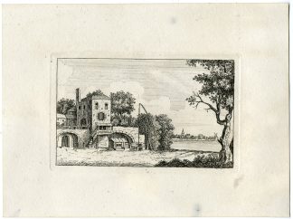
![stage decor-gysbrecht van amstel-monastery [ANONYMOUS, 1787]](https://pictura-prints.com/wp-content/uploads/2019/03/pco-4835-324x252.jpg)

Reviews
There are no reviews yet.