
 Print
Print Description
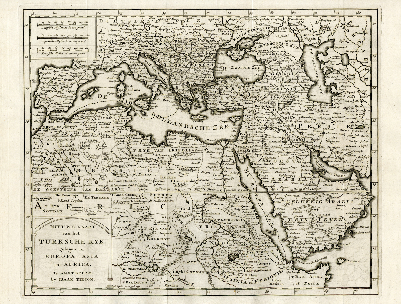
Subject: Antique print, titled: ‘Nieuwe Kaart van het Turksche Rijk gelegen in Europa, Asia en Africa’ – (‘New Map of the Turkish Empire, in Europe, Asia and Africa’). This detailed map shows the Ottoman Empire. The map area spans from Spain and North Africa in the left edge to the Caspian Sea and Saudi Arabia in the right side. This includes the whole of the Mediterranean area, as well as the areas around the Red, Black and Caspian seas.
Condition: Very good, given age. Original folds, as issued. Margin edges a little browned. Some faint offsetting from where the map was folded on itself. General age-related toning and/or occasional minor defects from handling. Please study scan carefully.
Medium: Engraving on hand laid paper.
Size (in cm): The overall size is ca. 41,6 x 33,8 cm. The image size is ca. 35 x 28,4 cm.
Size (in inch): The overall size is ca. 16,4 x 13,3 inch. The image size is ca. 13,8 x 11,2 inch.
Part Number: 69683
Location: PCO-B1-16
Description: From the 5th volume of “Hedendaagsche Historie of Tegenwoordige Staat van Alle Volkeren” (Tirion, 1733).
Artists and Engravers: Made by ‘Jacob Keyser’ after own design. Jacob Keizer is a Dutch engraver and cartographer active in the first half of the 18th century. Little is known of his life; according to Waller (p. 173) he was active in Russia and Amsterdam, and later Almelo.

Reviews
There are no reviews yet.