

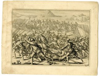
Description
Lithograph on thin wove paper. on paper.
Size in cm: The overall size is ca. 27.6 x 21 cm. The image size is ca. 24.8 x 17.9 cm. Size in inch: The overall size is ca. 10.9 x 8.3 inch. The image size is ca. 9.8 x 7 inch.
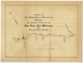
Antique print, titled: ‘Outline of the Mohawk river & Wood creek shewing the relative positions of Fort Bull, Fort Williams and the German Flatts.’ – Part of the course of Mohawk river, from German Flatts in the west to Fort Bull (near Oneida) in the east. “Maps in the offices of Secr. Of State and Surveyor General”, Albany: Richard H. Pease, ca. 1850. Cartographers were David Vaughan, E.O. Olmsted and M.E. Seymour.Artists and Engravers: Made by ‘Richard H. Pease’ after an anonymous artist. Printer / publisher: Richard H. Pease (1813-1869) was an engraver / lithographer and printer from Albany.
Condition: Excellent, given age. Original folds as issued. Offsetting of the letter press title from where the sheet was folded. Some tiny stains. General age-related toning and/or occasional minor defects from handling. Please study scan carefully.
Keywords: ANTIQUE PRINT-MOHAWK-FORT BULL-WILLIAMS-NEW YORK-USA-PEASE
(PCO) C130-11


Reviews
There are no reviews yet.