
 Print
Print Description
Lithograph on wove paper. on paper.
Size in cm: The overall size is ca. 22.4 x 14 cm. The image size is ca. 18.1 x 11.3 cm. Size in inch: The overall size is ca. 8.8 x 5.5 inch. The image size is ca. 7.1 x 4.4 inch.
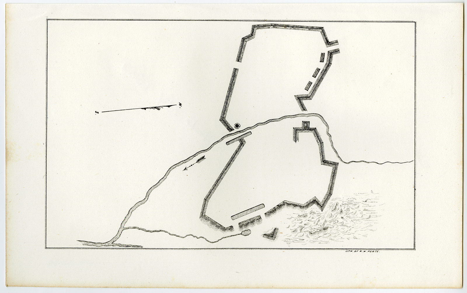
Antique print, untitled. Unidentified fortification outline, detailing the walls erected on two sides of a river. This is a lithographically made map from ca. 1849. “Maps in the offices of Secr. Of State and Surveyor General”, Albany: Richard H. Pease, ca. 1850. Cartographers were David Vaughan, E.O. Olmsted and M.E. Seymour.Artists and Engravers: Made by ‘Richard H. Pease’ after an anonymous artist. Printer / publisher: Richard H. Pease (1813-1869) was an engraver / lithographer and printer from Albany.
Condition: Excellent, given age. General age-related toning and/or occasional minor defects from handling. Please study scan carefully.
Keywords: ANTIQUE PRINT-FORT-RIVER-FORTIFICATION-USA-PEASE
(PCO) C130-21
![Antique Map - Ferrybridge te Boroughbridge [John Ogilby, 1675]](https://pictura-prints.com/wp-content/uploads/2019/08/pco-7988-324x252.jpg)
![[SEPP and NOZEMAN] Turdus Arundinaceus minimus (Icterine Warbler)](https://pictura-prints.com/wp-content/uploads/2018/07/pcorc064-324x457.jpg)
![[Hubertus QUELLINUS] Ornamental decoration: Mayor's chamber, Amsterdam City Hall (2 plates)](https://pictura-prints.com/wp-content/uploads/2018/07/pcom_0338-324x211.jpg)


Reviews
There are no reviews yet.