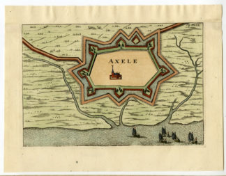
Antique Print-ANTIQUE MAP-AXELE-AXE-BELGIUM-Veelwaard-1735

Print

59.00

This is an original antique plan of Axele (Axel), Belgium, from “Verheerlijkt Vlaanderen” (Flandria Illustrata), by Antonius Sanderius. This antique map was printed in 1735, well inked and is in fine condition.this map has an added upper margin to avoid framing problems. (invisible after framing ).The overall size is 11 inch x 8,5 inch. The image size is 9 1/4 inch x 6 1/4 inch.

In stock

SKU: 00786 Category: Tag:

Description

etching / engraving on hand laid (verg?) paper.
Sheet size: x cm. (0 x 0 inch). Image size: x cm. (0 x 0 inch).

Source unknown, to be determined.

Anonymous.

Condition: Good, given age. General age-related toning and/or occasional minor defects from handling. Please study scan carefully.

Keywords:

ISCRA PCO-A1-09

Additional information

Dimensions 1 cm

Reviews

There are no reviews yet.

Be the first to review “Antique Print-ANTIQUE MAP-AXELE-AXE-BELGIUM-Veelwaard-1735”

You might also like: