
Description
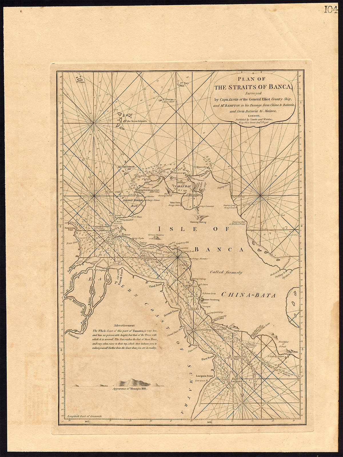
Map : ‘Plan of the Straits of Banca Surveyed by Captn. Lloyd of the General Elliot Country Ship, and Mr. Bampton in his Passage from China to Batavia, and from Batavia to Malaca’. This rare map offers rich detail including countless depth soundings, notes on the sea floor, commentary on reefs and shoals (e.g. ‘a dangerous shoal omitted in almost all the charts’), rhumb lines, place names and a wealth of other practical information for the mariner. Cartographically it was derived from surveys by Captain Joseph Huddart, John Price, and a Mr McDonald.
Made by after an anonymous artist.
Medium: engraving / etching on wove paper.
Sheet size: 44 x 60 cm (17.32 x 23.62 inch). Image size: 33 x 48 cm. (12.99 x 18.9 inch).
Condition: good, given age. Paper browned and light staining/soiling from handling as visible on image. Slight offsetting. Small tear right margin. Dampstain in the lower right margin. General age-related toning and/or occasional minor defects from handling. Please study scan carefully.
STRAITS OF BANCA-INDONESIA-SUMATRA | DP-A2-002-01
BACKGROUND INFORMATION
This original antique map was published by Laurie and Whittle, London 1796. James Whittle, English publisher.
Biography engraver: Robert Laurie (c. 1755?1836) was an Anglo-Scottish mezzotint engraver and publisher. He signed his name as Lowery, Lowry, Lowrie, Lawrey, Lawrie, or Laurie.


Reviews
There are no reviews yet.