
Description
Engraving on hand laid paper. on paper.
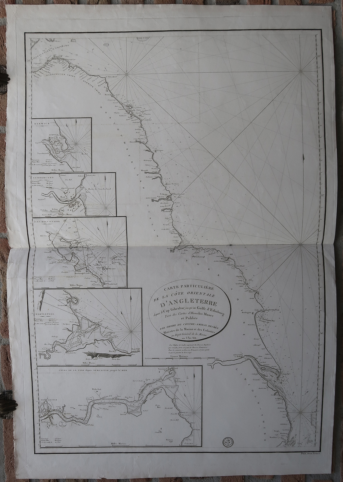
Size in cm: The overall size is ca. 67.8 x 99.3 cm. The image size is ca. 61 x 88.4 cm. Size in inch: The overall size is ca. 26.7 x 39.1 inch. The image size is ca. 24 x 34.8 inch.
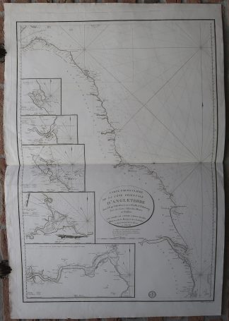
Antique map, titled: ‘Carte Particuliere de la Cote Orientale d’Angleterre depuis le Cap Gibraltar jusqu’au Golfe d’Edinburg […].’ – A sea chart of the coast of Great Britain, from Kingston upon Hull and the Humber river North to Edinburgh. This includes part of Lincolnshire, Yorkshire, Durham and Northumberland. Five inset maps show: Berwick-upon-Tweed, Sunderland, Holy and Farne Islands, Hartlepool and river Tyne to Newcastle. The map shows depth soundings along the coast and coastal towns/villages. Some current directions are indicated using small arrows. Published by the Depot de la Marine in An XII (1803-1804).Artists and Engravers: Anonymous.
Condition: Very good, given age. Original middle fold, as issued. Some offsetting where the map was folded on itself. Some small imperfections (creasing in the corners and small nicks) in the margin edges. Minimal paper loss in the lower margin. Some creasing along the middle fold. A small stain in the middle fold. General age-related toning and/or occasional minor defects from handling. Please study scan carefully.
Keywords: ANTIQUE MAP-SEA CHART-ENGLAND-KINGSTON-NEWCASTLE-DEPOT DE LA MARINE
(PCO) GK-077

![Emblem XXIX-Love Portrait-after Jesus-Painter [After SNYDERS, 1626]](https://pictura-prints.com/wp-content/uploads/2019/04/pco-5028-324x501.jpg)


Reviews
There are no reviews yet.