
Description
Engraving on hand laid paper. on paper.
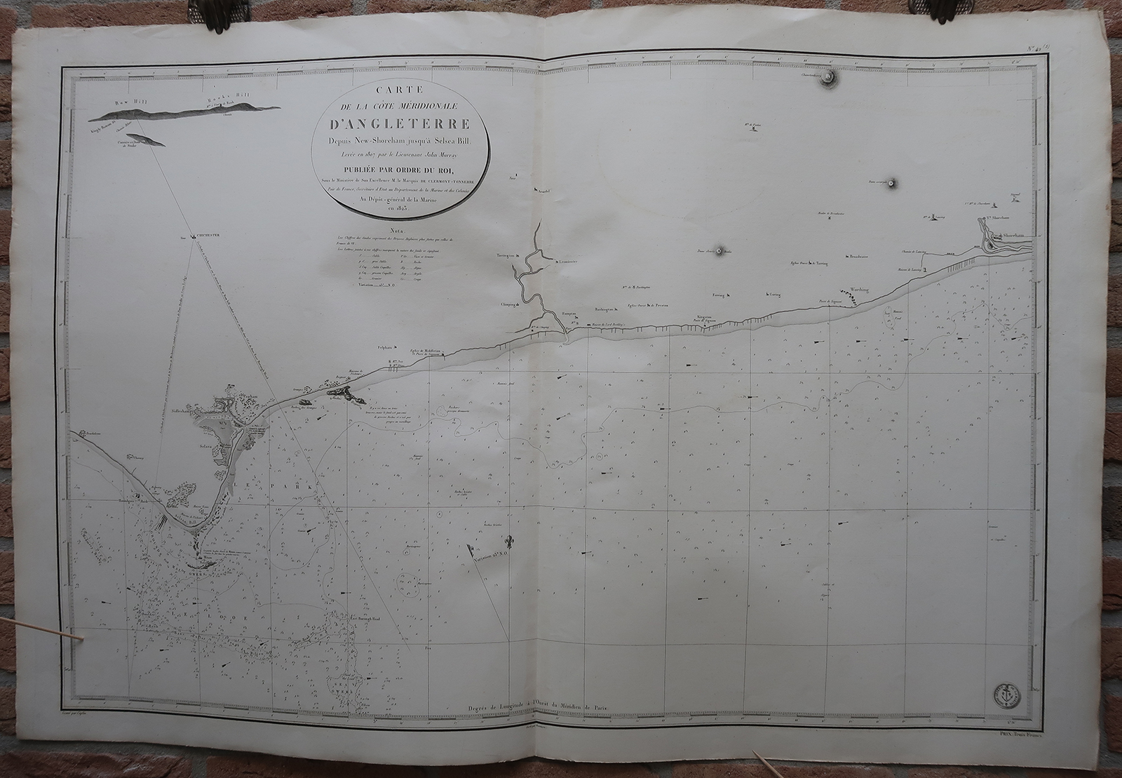
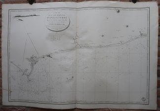
Size in cm: The overall size is ca. 102.3 x 68.8 cm. The image size is ca. 93.1 x 61.8 cm. Size in inch: The overall size is ca. 40.3 x 27.1 inch. The image size is ca. 36.7 x 24.3 inch.
Antique map, titled: ‘Carte de la Cote Meridionale d’Angleterre Depuis New-Shoreham jusqu’a Selsea Bill.’ – A sea chart of the South coast of England, from Selsey to Shoreham-by-Sea. Chichester is the main city indicated. This area includes Worthing. Detailed depth soudings along the coast, and coastal towns and geographical features indicated. Small arrows indicate current directions. Published by the Depot de la Marine. Engraved by Caplin, the lettering by Besancon.Artists and Engravers: Anonymous.
Condition: Very good, given age. Original middle fold, as issued. Some offsetting where the map was folded on itself. Some small imperfections in the margins. General age-related toning and/or occasional minor defects from handling. Please study scan carefully.
Keywords: ANTIQUE MAP-SEA CHART-ENGLAND-CHICHESTER-WORTHING-DEPOT DE LA MARINE
(PCO) GK-075
![Attagen, Upupa, Vespertilio [Johann SCHEUCHZER after PINTZ, 1731]](https://pictura-prints.com/wp-content/uploads/2018/10/pcom-616-324x533.jpg)


Reviews
There are no reviews yet.