
Description
Engraving on hand laid paper. on paper.
Size in cm: The overall size is ca. 102.8 x 69.2 cm. The image size is ca. 93.4 x 61.6 cm. Size in inch: The overall size is ca. 40.5 x 27.2 inch. The image size is ca. 36.8 x 24.3 inch.
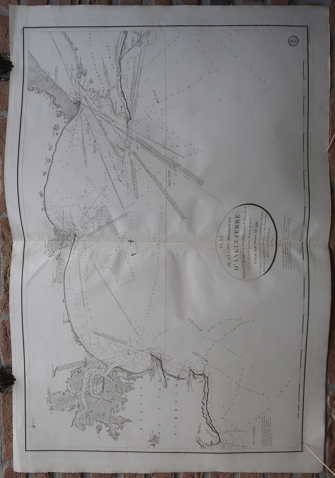
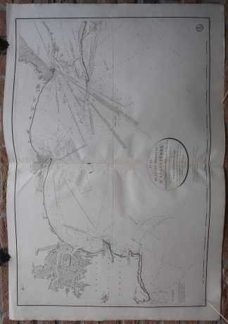
Antique map, titled: ‘No. 44: Plan de la Cote Meridionale d’Angleterre Depuis la P.te Blackwood de l’Ile de Wight jusqu’a St. Alban’s Head.’ – Map of the South coast of England, Dorset, from Worth Matravers East to Yarnmouth on the Isle of Wight. This region includes Bournemouth and Christchurch. Depth soundings are given, as well as current directions and speeds, with places along the coast indicated. This map is based on the 1785 map by Mackenzie, published in 1824 by the Depot General de la Marine.Artists and Engravers: Made by ‘Jean-Francois-Isidore Caplin’ after ‘Murdoch Mackensie’. Jean-Francois-Isidore Caplin (born 1779) was a French engraver and watercolourist, born in Paris. The lettering was engraved by Besancon. We have not been able to find more information on this person. Murdoch Mackenzie (1712–1797) was a Scottish hydrographer and cartographer. He is mainly remembered for his survey of the Orkney Islands.
Condition: Good, given age. Original middle fold, as issued. Some soft creasing along the middle fold. Some faint offsetting where the map was folded on itself. General age-related toning and/or occasional minor defects from handling. Please study scan carefully.
Keywords: ANTIQUE MAP-SEA CHART-ENGLAND-DORSET-WIGHT-BOURNEMOUTH-DEPOT DE LA MARINE
(PCO) GK-117

Reviews
There are no reviews yet.