


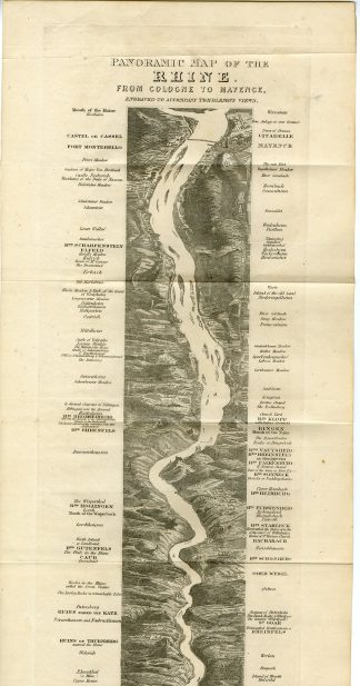
Description
Medium: Steel engraving on wove (vellin) paper.
Sheet size: 13.6 x 60 cm (5.35 x 23.62 inch). Image size: 10 x 50 cm. (3.94 x 19.69 inch).
Condition: good, given age. Fold lines visible, light foxing, no tears. General age-related toning and/or occasional minor defects from handling. Please study scan carefully.
RHINE MAP, PANORAMIC, TOMBLESON, GERMANY, COLOGNE, MAINZ, RIVER, TRAVEL, 19TH CENTURY | PCO-C1-29
BACKGROUND INFORMATION
Tombleson’s Views of the Rhine’, Volume 1, first edition, 1832, published by Black & Armstrong, London. Foreign Booksellers to the King.
Biography artist: William Tombleson (1795-1846) was a British topographical artist, illustrator, and engraver. He is best known for his detailed and picturesque views of European rivers, particularly the Rhine and the Thames.


Reviews
There are no reviews yet.