
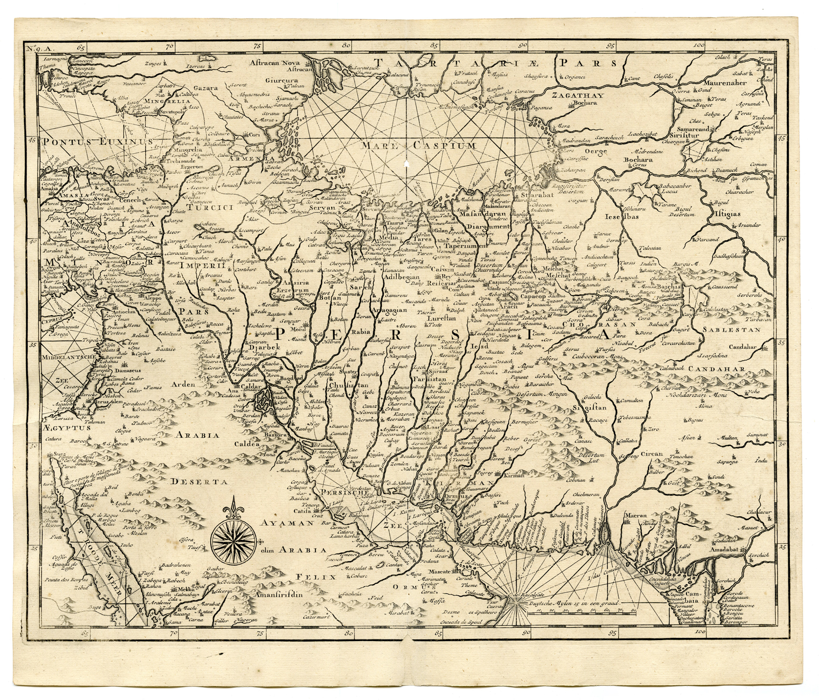
Description
Copperplate engraving/etching on hand laid (verge) paper. Watermark: French Lily and monogram IV.
Sheet size: 39 x 33 cm. (15,4 x 13 inch). Image size: 37,7 x 29,6 cm. (14,8 x 11,7 inch).
From the monumental work by François Valentyn: “Oud en nieuw Oost-Indiën, vervattende een naaukeurige en uitvoerige verhandelinge van Nederlands mogentheyd in die gewesten”. Dordrecht/Amsterdam: J. van Braam en G. onder de Linden, 1724/1726. (Transl.: Old and new East-Indies, including an accurate and extensive description of Dutch / VOC controlled territories.)
Made by an anonymous engraver after Francois Valentijn / VOC sources.
Condition: Very good, given age. Small hole at top middle fold. Hole at bottom margin, backed. Light foxing. General age-related toning and/or occasional minor defects from handling. Please study scan carefully.
Keywords: PERSIA-IRAN-IRAQ
PCO-A8-46

Reviews
There are no reviews yet.