
Description
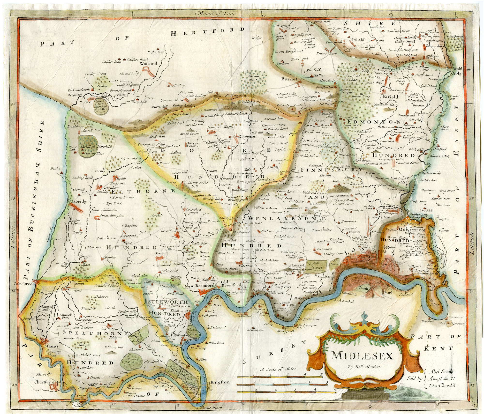
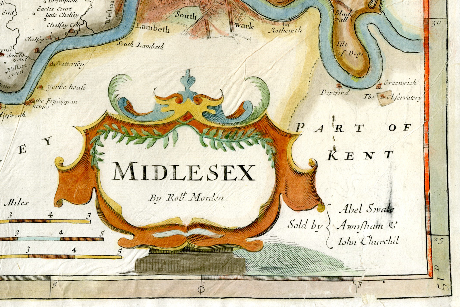
This print shows a map of Middlesex in the U.K. Place names include London, Brentford, Stepney, Staines, Kensington, Hammersmith, Bushey Park, Enfield and Edgware.
Made by Robert Morden after Camcen.
Medium: Engraving / handcoloured on hand laid (verge) paper.
Sheet size: 43 x 37.5 cm (16.93 x 14.76 inch). Image size: 42 x 36 cm. (16.54 x 14.17 inch).
Condition: good, given age. Fold as published. In three corners paperloss restored. Remains of glue on reverse. Creases and folds. General age-related toning and/or occasional minor defects from handling. Please study scan carefully.
MAP-MIDDLESEX-ENGLAND-LONDON-KENSINGTON-BRENTFORD | RB-A8-36
BACKGROUND INFORMATION
This attractive print was published in Camden’s Britannia ca 1722.
Biography engraver: Robert Morden (1650-1703).


Reviews
There are no reviews yet.