
Description
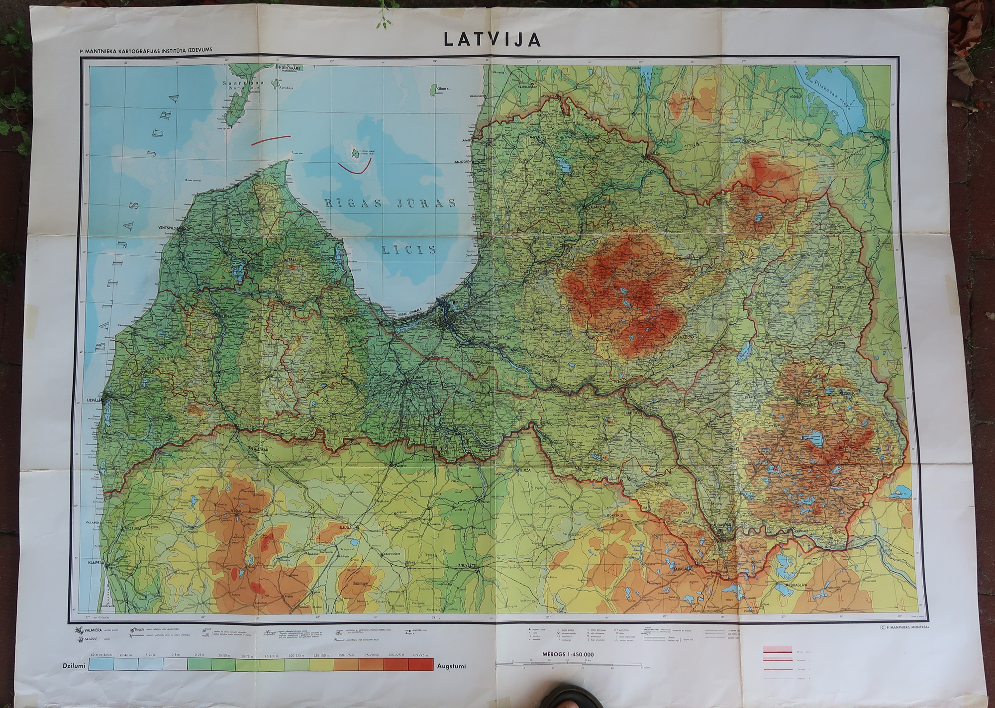
This print shows the map of Latvija, Lithuania, one of the Baltic States. Parts of Poland can be seen.
Made by after an anonymous artist.
Medium: Colour print on wove paper.
Sheet size: 116 x 87 cm (45.67 x 34.25 inch). Image size: 104 x 76.5 cm. (40.94 x 30.12 inch).
Condition: good, given age. Folds as published. Small tears margin and corners of the folds restored. Folds in upper and lower margins. Tape in corners. General age-related toning and/or occasional minor defects from handling. Please study scan carefully.
MAP-LITHUANIA-BALTIC STATE-EASTERN EUROPE-POLAND | RB-A8-35
BACKGROUND INFORMATION
This attractive print was published in Belgium, ca 1950-1960.


Reviews
There are no reviews yet.