
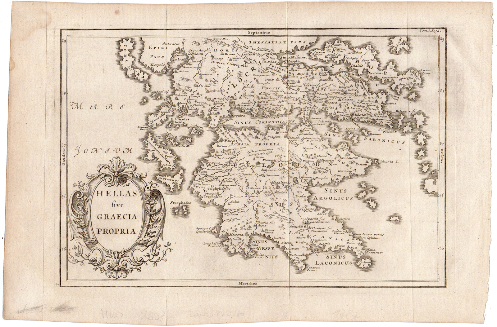
Description
This print shows a map of Greece, Europe.
Made by Anonymous after own design.
Medium: Engraving on hand laid (verge) paper.
Sheet size: 38.7 x 25.7 cm (15.24 x 10.12 inch). Image size: 31 x 21 cm. (12.2 x 8.27 inch).
Condition: good, given age. Folds as published. Brown stains. Remains of pencil writing. General age-related toning and/or occasional minor defects from handling. Please study scan carefully.
MAP-HELLAS-GREECE-EUROPE-ISLANDS | RB-A8-28
BACKGROUND INFORMATION
This attractive print was published in Geschichte des Polybius mit den Auslegungen des Ritters (..) Folard,
part 3, Berlin (G.L.Winter) 1756, after p. 144. in 1757.


Reviews
There are no reviews yet.