


Description
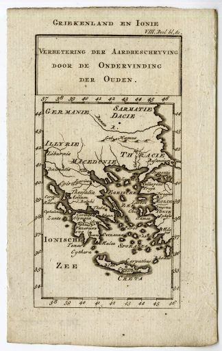
This print shows a map of Boeotia, Greece.
Made by C. Mare after Karl Otfried Muller.
Medium: engraving on hand laid paper.
Sheet size: 41.5 x 35.5 cm (16.34 x 13.98 inch). Image size: 25 x 27 cm. (9.84 x 10.63 inch).
Condition: good, given age. Folds as published. Brown stains. . General age-related toning and/or occasional minor defects from handling. Please study scan carefully.
MAP-BOEOTIA-BOEOTIEN-GREECE-ISLANDS | RB-A8-28
BACKGROUND INFORMATION
This attractive print was published in Zur allgemeinen Encyclopedie der K?nste und Wissenschaft from Erch and Gruber.

![NATIVES-NEGRO-AFRICA-PALM TREE [Jakob VAN DER SCHLEY after PREVOST-COCHIN, 1747]](https://pictura-prints.com/wp-content/uploads/2019/01/pco-2499-324x397.jpg)


Reviews
There are no reviews yet.