
Description
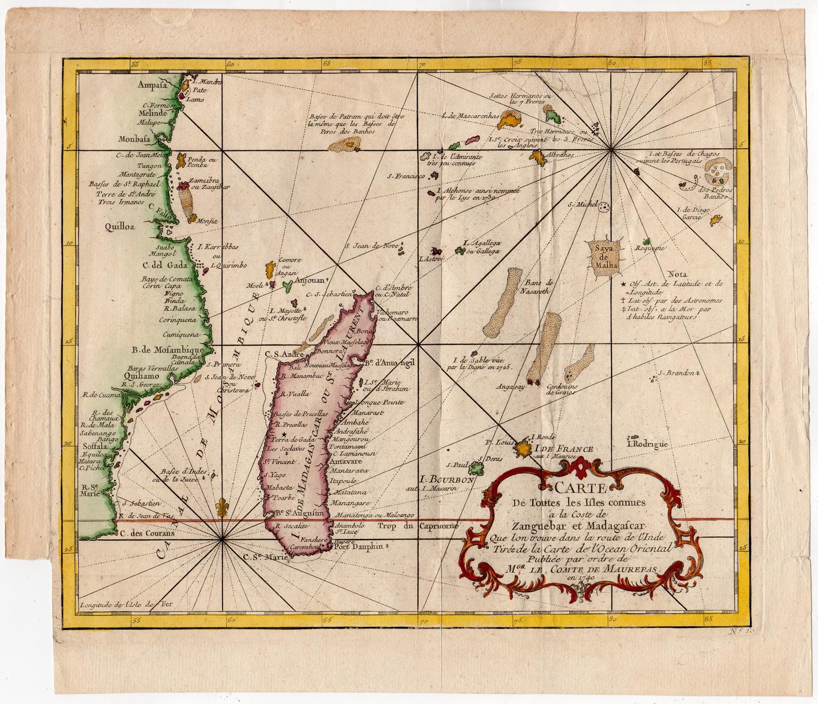
Original antique map showing the east coast of Africa with Madagascar. Extends from Pate Island (Kenya) to southern Mozambique, encompassing to the west the islands of Madagascar, Reunion (“Bourbon”), Mauritius (“Ile de France”), Rodrigue, and the Comoros, Seychelles, and Chagos archipelagos.
Made by after an anonymous artist.
Medium: Engraving / etching with hand colouring on hand laid (verge) paper. Watermark: yes.
Sheet size: 33.2 x 38.2 cm (13.07 x 15.04 inch). Image size: 28.2 x 23.5 cm. (11.1 x 9.25 inch).
Condition: fair, given age. Original folds as published. Crinckles and creases. Repaired tears in right and upper margin. Old restoration in upper part. General age-related toning and/or occasional minor defects from handling. Please study scan carefully.
MADAGASCAR-ZANZIBAR-MOZAMBIQUE-REUNION-MAURITIUS-COMORES | RB-A9-10
BACKGROUND INFORMATION
From the atlas of Prevost d’Exiles’ influential collection of travel narratives, Histoire Generale des Voyages. Published by Comte de Jean-Frederic Maurepas (1701- 1781) Versailles; issued in Paris 1740. He was a French statesman and Count of Maurepas skilled in military and naval strategy. Maurepas enabled the French navy to regain previously lost prestige and France was once again recognized as a maritime power One way that he improved the French reputation was by focusing on the defense of France’s sprawling empire in the New World especially in the 1730s and 1740s, 1701.
Biography engraver: Jacques Nicolas Bellin (French, 1703-1772) was a French hydrographer, geographer and member of The Philosophes. His career, spanning over 50 years, caused an enormous outpt in maps, particular of maritime interest.

Reviews
There are no reviews yet.