
Description
Etching/engraving on hand laid paper. on paper.
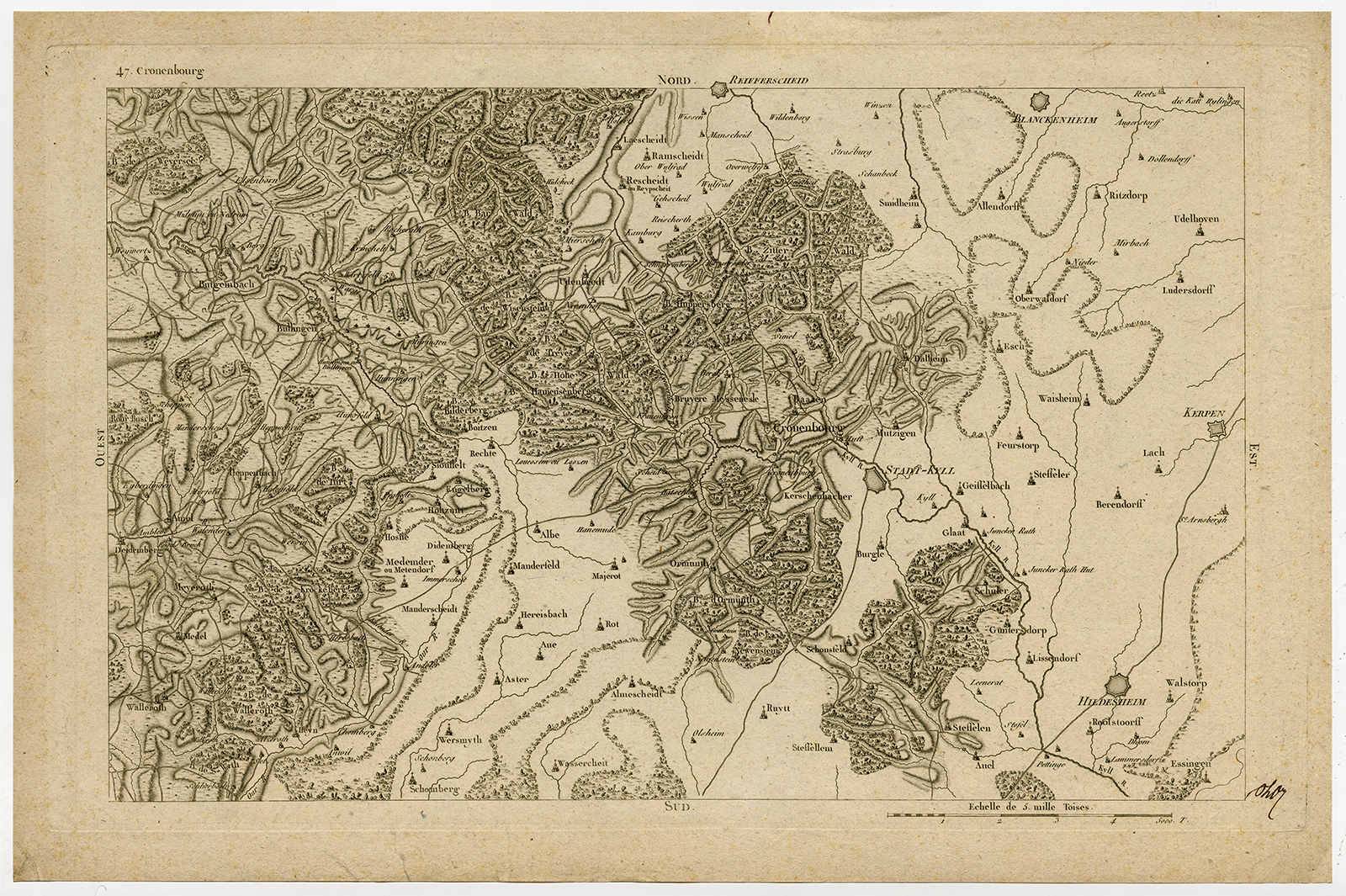
Size in cm: The overall size is ca. 51.2 x 33.7 cm. The image size is ca. 45.2 x 28.5 cm. Size in inch: The overall size is ca. 20.2 x 13.3 inch. The image size is ca. 17.8 x 11.2 inch.
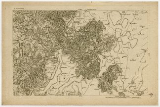
Antique print, titled: ‘Cronenbourg.’ – A map of Kronenburg, an old town in the German-Belgian border area, located on the Kyll. Kronenburg in North Rhine-Westphalia, Germany. From “Carte Chorographique de la Belgique en soixante neuf feuilles”, Paris: J.B. Delaval [1797]. Map no. 47.Artists and Engravers: Made by an anonymous engraver after ‘Joseph Jean Francois, Count of Ferraris’. Joseph Jean Francois, count de Ferraris (Luneville, April 20, 1726 – Vienna, April 1, 1814) was an Austrian general and cartographer.
Condition: Very good, given age. A manuscript monogram in the lower right corner. Small stains in margin. General age-related toning and/or occasional minor defects from handling. Please study scan carefully.
Keywords: ANTIQUE MAP-KRONENBURG-KYLL-WESTPHALIA-47-GERMANY-FERRARIS
XXX-B1-27

![SNAKE STONE-COBRA-CHINA-TEMPLE-PAGODA [After KIRCHER, 1667]](https://pictura-prints.com/wp-content/uploads/2019/04/pcom-166-324x486.jpg)

Reviews
There are no reviews yet.