
Description
Etching/engraving on hand laid (verge) paper. on paper.
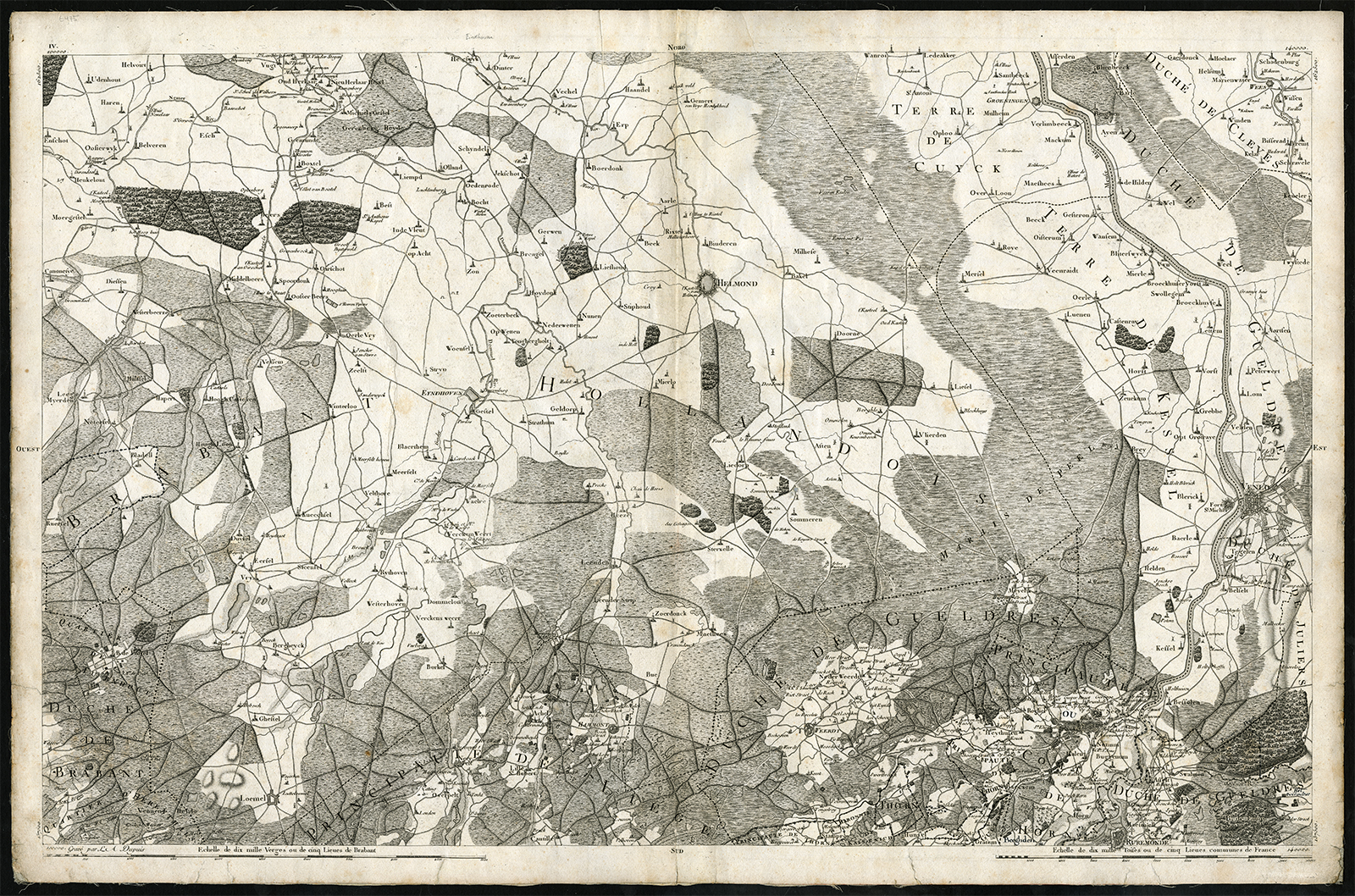
Size in cm: The overall size is ca. 93.5 x 61.5 cm. The image size is ca. 89 x 57.5 cm. Size in inch: The overall size is ca. 36.8 x 24.2 inch. The image size is ca. 35 x 22.6 inch.
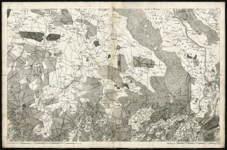
Antique print, untitled. A map of parts of the province Brabant, in both the Netherlands and Belgium. Part of Limburg is also shown. Cities included are Roermond, Venlo, Helmond and Venlo, as well as numerous villages in the area. “Carte chorographique des Pays-Bas Autrichiens”, a 25-sheet map of the Austrian Netherlands published in 1777. Artists and Engravers: Made by ‘L.A. Dupuis’ after ‘Ferraris’. L.A. Dupuis (active 1770-1810) was an engraver. We have not been able to find more about this person. Joseph Jean Francois, count de Ferraris (Luneville, April 20, 1726 – Vienna, April 1, 1814) was an Austrian general and cartographer.
Condition: Very good, given age. Original middle folds, as issued. Doubled on (backed with) linen. Some small tears in the margins, now closed by the linen backing. Two creases from the top margin a little into the image. General age-related toning and/or occasional minor defects from handling. Please study scan carefully.
Keywords: ANTIQUE MAP-BRABANT-EINDHOVEN-HELMOND-VENLO-ROERMOND-DUPUIS-FERRARIS
XXX-B1-34


Reviews
There are no reviews yet.