


Description
Medium: Contemporary (original / old) hand coloured etching / engraving on hand-laid (verge) paper.
Sheet size: 58.5 x 41.3 cm (23.03 x 16.26 inch). Image size: 52.2 x 38.7 cm. (20.55 x 15.24 inch).
Condition: good, given age. Paper separation at the lower middle fold (backed), original middle fold as issued. Light brown offsetting from colors on opposing pages (common for this type of map). General age-related toning and/or occasional minor defects from handling. Please study scan carefully.
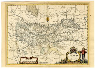
NETHERLANDS, GELDERLAND, BETUWE, TIELERWAARD, BOMMELERWAARD, NIJMEGEN, JANSSONIUS, DUTCH CARTOGRAPHY, 17TH-CENTURY MAPS, RIVER MAPS, HISTORICAL GEOGRAPHY | MAPS-LARGE
BACKGROUND INFORMATION
‘Atlas Novus sive Theatrum Orbis Terrarum’, Amsterdam: Johannes Janssonius, 1647. This Atlas was published 1638-66. This item is from the 1647 latin ed. .
Biography engraver: Johannes Janssonius also known as Jan Jansson (1588-1664) was born in Arnhem, Netherlands. His father was a bookseller and publisher (Jan Janszoon the Elder). When he married the daughter of the cartographer Jodocus Hondius he also set up a business as book publisher in Amsterdam. His first map was published in 1616. Around 15 years later he set up a partnership with his brother in law Hondius add issued further editions of the Mercator/Hondius atlas. After his death his heirs still have published several maps. Many of his plates have been acquired by Pieter Schenk and Gerard Valk.

Reviews
There are no reviews yet.