


Description
Medium: Copper engraving, hand-colored on hand laid (verge) paper.
Sheet size: 52.2 x 41.7 cm (20.55 x 16.42 inch). Image size: 49.5 x 38.5 cm. (19.49 x 15.16 inch).
Condition: good, given age. Well-preserved, strong impression, original hand-coloring. Light foxing, creasing and soiling. General age-related toning and/or occasional minor defects from handling. Please study scan carefully.
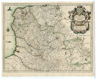
ARTOIS, FRANCE, HISTORICAL MAP, BLAEU, WILLEM BLAEU, JOAN BLAEU, 17TH-CENTURY CARTOGRAPHY, ANTIQUE MAPS, THEATRUM ORBIS TERRARUM | MAPS-LARGE
BACKGROUND INFORMATION
Theatrum Orbis Terrarum, Willem & Joan Blaeu, 1635.
Reference: Van der Krogt 2 – 3300:2.
Biography engraver: Willem Janszoon Blaeu (1571-1638) was one of the most influential Dutch cartographers and publishers of the 17th century. He specialized in maritime cartography and was appointed Hydrographer of the VOC in 1633. His son, Joan Blaeu (1596-1673), continued his legacy, producing the monumental Atlas Major and expanding the family’s publishing empire.


Reviews
There are no reviews yet.