


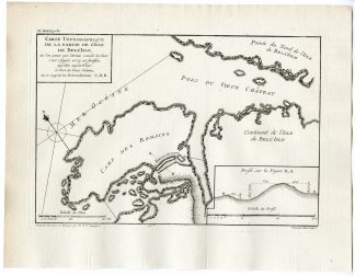
Description
Original antique map of the current African territories of Somalia, Djibouti, Yemen and the island of Zanzibar.
Made by an anonymous engraver after Rigobert Bonne.
Medium: Engraving / etching on hand laid (verge) paper. Watermark: yes.
Sheet size: 31 x 43 cm (12.2 x 16.93 inch). Image size: 23 x 34.5 cm. (9.06 x 13.58 inch).
Condition: good, given age. Original folds as published. Light foxing. Crinkles in top margin and a few small repaired tears. General age-related toning and/or occasional minor defects from handling. Please study scan carefully.
AFRICA-SOMALIA-DJIBOUTI-YEMEN-ZANZIBAR-MADAGASKAR | RB-A9-10
BACKGROUND INFORMATION
Published in France 1787. .
Biography artist: Rigobert Bonne (1727-1795) was one of the most important cartographers of the late eighteenth century. In 1773 he succeeded Jacques Bellin as royal cartographer in France. .


Reviews
There are no reviews yet.