

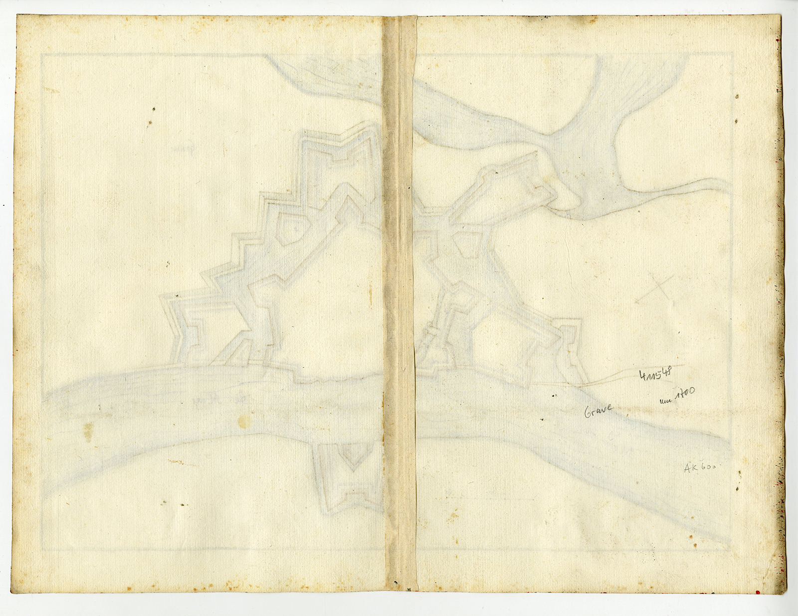
Description
Medium: Hand-drawn manuscript map, watercolor and ink on hand laid (verge) paper.
Condition: good, given age. Some light foxing and minor creases, but well-preserved colors and clear details. General age-related toning and/or occasional minor defects from handling. Please study scan carefully.
MANUSCRIPT MAP, GRAVE, FORTRESS, FORTIFICATIONS, DUTCH MILITARY MAPS, HISTORICAL CARTOGRAPHY, 17TH CENTURY MAPS, STAR FORT, DEFENSE ARCHITECTURE, RIVER MAAS | EXPO-MAPS-LARGE
BACKGROUND INFORMATION
Likely from a military or strategic cartographic archive, possibly linked to the Dutch War of Independence or later European conflicts.

Reviews
There are no reviews yet.