
 Print
Print Description
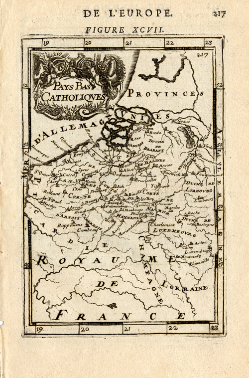
Original copper engraving on a vellin type paper. on paper.
Size in cm: The overall size is ca. 14 x 21.5 cm. The image size is ca. 10 x 15 cm. Size in inch: The overall size is ca. 5.5 x 8.5 inch. The image size is ca. 3.9 x 5.9 inch.
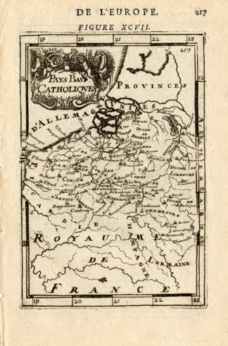
Map: ‘Pays Bas Catholiques.’ (Map of the Catholic Netherlands.) This map shows the southern Netherlands/Belgium. Cartouche with horses. This map is from a French edition. We carry similar maps from a German edition as well. Please inquire if interested. This small map originates from: ‘Les travaux de Mars ou l’Art de la guerre divise en trois parties. La premiere, enseigne la methode de fortifier toutes fortes de places … La seconde, explique leurs constructions … La troisieme, enseigne les fonctions de la cavalerie …’ by A.M. Mallet, published in Amsterdam by Jan & Gills a’Waesbergue & Compagnie, 1684.Artists and Engravers: Alain Manesson Mallet, a French engineer and mathematician, born 1630 in Paris. His major work was the “Description de l’Univers” first published 1683. He died in 1703.
Condition: Excellent. General age related toning and occasional light staining from handling as visible on image.
Keywords: ANTIQUE MAP-SOUTHERN NETHERLANDS-BELGIUM-MALLET
PCOX-C3-11

Reviews
There are no reviews yet.