
 Print
Print Description
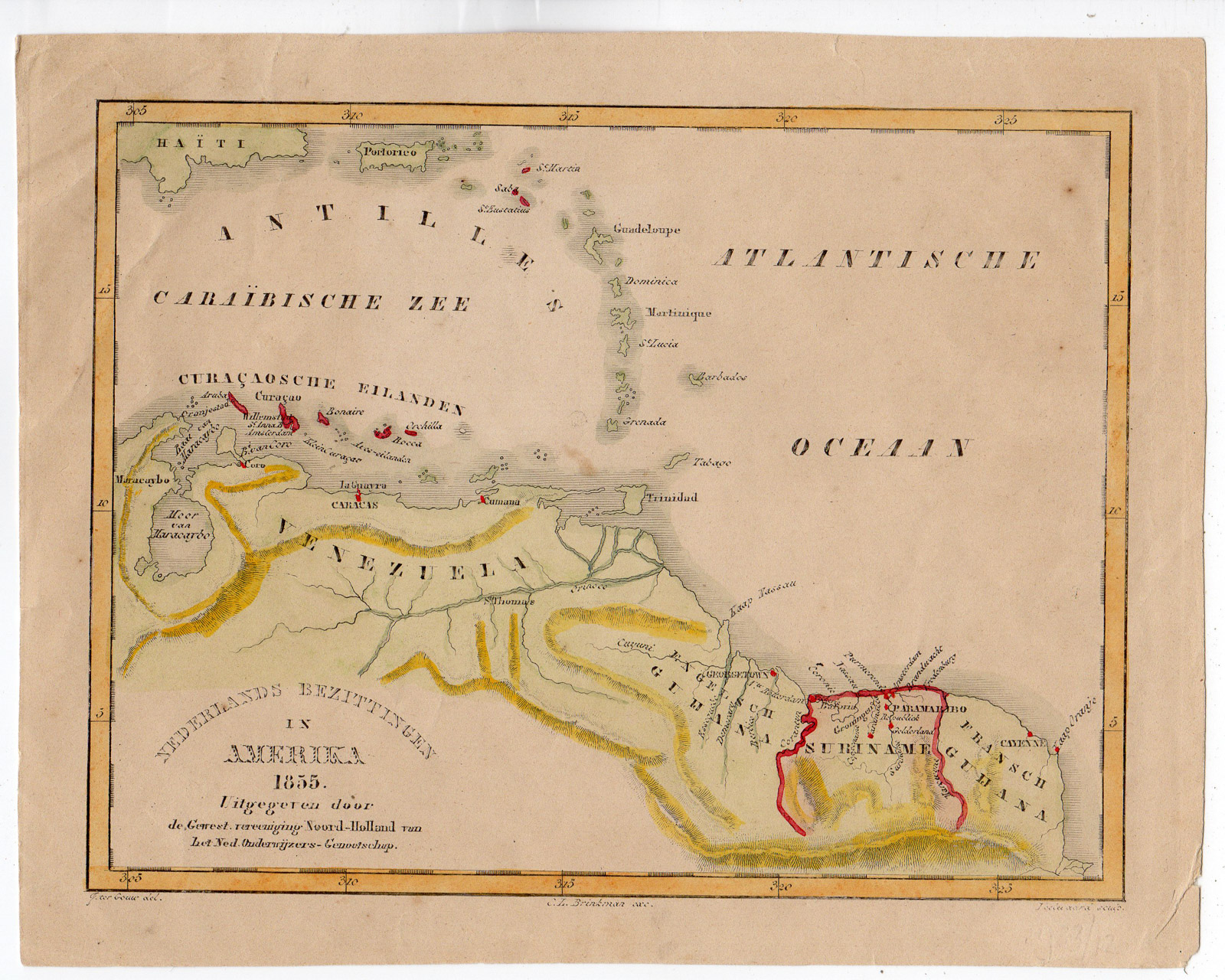
This print shows a map of the coast of South America with Surinam and Antilles marked as Dutch colony. We also see Venezuela, Guiana.
Made by Veelwaard after J. ter Gouw.
Medium: Lithography .
Sheet size: 21.5 x 17 cm (8.46 x 6.69 inch). Image size: 18.8 x 14.5 cm. (7.4 x 5.71 inch).
Condition: good, given age. Creases. Small stains. Tear restored in right corner. General age-related toning and/or occasional minor defects from handling. Please study scan carefully.
COLONIAL MAP-SURINAM-ANTILLES-GUIANA-VENEZUELA | RBOS-A8-53
BACKGROUND INFORMATION
This attractive print was published by Het Nederlands Onderwijzers Genootschap (Dutch society of teachers) in 1855.
Biography engraver: Daniel Veelwaard Junior (1796-1868) was a Dutch engraver and map-engraver, pupil of his father Daniel Veelwaard.


Reviews
There are no reviews yet.