
![Fossa Eugeniana quae a rheno ad mosam duci coepta est (…) [Henricus HONDIUS after , c. 1635]](https://pictura-prints.com/wp-content/uploads/2018/09/pco-2019.jpg "Pco 2019 416x353")
![Fossa Eugeniana quae a rheno ad mosam duci coepta est (…) [Henricus HONDIUS after , c. 1635] - Image 2](https://pictura-prints.com/wp-content/uploads/2018/09/pco-2023.jpg "Pco 2023 416x348")
Description
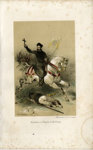
Fossa Eugeniana quae a rheno ad mosam duci coepta est (…)
Copperplate engraving/etching. on hand laid (verge) paper.
Sheet size: 55,8 x 45,2 cm. Image size: 49 x 37 cm.
Source unknown, to be determined.
Made by Henricus Hondius after an anonymous artist. Henricus Hondius II or Hendrik Hondius the Younger (1597 – 16 August 1651) was a Dutch engraver, cartographer and publisher. He was born in Amsterdam, the son of the famous cartographer Jodocus Hondius who had started a map-making business in the city. Henricus obtained the original plates of the Mercator 1569 world map, and published a 1606 version of it. After his father died in 1612 Henricus co-ran the business with his brother-in-law.[1] In 1621 opened his own company in his hometown. The first time his name was mentioned in an atlas was in 1623 when he published the fifth edition of the Mercator-Hondius atlas. After 1628 Henricus partnered with the cartographer Jan Janssonius and together they continued the business.
Condition: Good, given age. Light foxing, mainy in the margins. Original middle fold as issued. General age-related toning and/or occasional minor defects from handling. Please study scan carefully.
Keywords: FOSSA EUGENIA-CANAL-VENLO-RIJN-MAAS
pco-maps-benelux
![[SEPP and NOZEMAN] Motacilla Flava (Yellow Wagtail)](https://pictura-prints.com/wp-content/uploads/2018/07/pcorc065-324x457.jpg)
![VELVET SCOTER-DUCK-MELANITTA FUSCA 'Anas fusca' [SEPP and NOZEMAN, 1770]](https://pictura-prints.com/wp-content/uploads/2018/07/pcorc225-324x459.jpg)
![CCCXLIII. Donaria pro Sacerdotibus. [Johann SCHEUCHZER after PINTZ, 1731]](https://pictura-prints.com/wp-content/uploads/2018/10/pcom-0754-e1540471943262-324x491.jpg)
![CCCXXXV. Animalia munda. [Johann SCHEUCHZER after HEUMANN, 1731]](https://pictura-prints.com/wp-content/uploads/2018/10/pcom-0688-e1540470635383-324x509.jpg)
![Abundantia Camelorum obruens [Johann SCHEUCHZER after FRIDERICH, 1731]](https://pictura-prints.com/wp-content/uploads/2018/10/pcom-651-324x491.jpg)
![CCCCIX. Ursa catulis orbata. [Johann SCHEUCHZER after HEUMANN, 1731]](https://pictura-prints.com/wp-content/uploads/2018/10/pcom-0751-e1540471919515-324x536.jpg)
![[Hubertus QUELLINUS] La Justice au dessus de la Chambre des Echevins sur la Grand Sale des Bourgeois](https://pictura-prints.com/wp-content/uploads/2018/07/pcom_0274-324x264.jpg)

![[Hubertus QUELLINUS] Interior of the Burgerzaal (Civil Chamber), Amsterdam City Hall](https://pictura-prints.com/wp-content/uploads/2018/07/pcom_0361-324x445.jpg)
![[SEPP and NOZEMAN] Sitta Europea (Nuthatch)](https://pictura-prints.com/wp-content/uploads/2018/07/pcorc290-324x457.jpg)
![Nova totius germaniae descriptio [Willem BLAEU after , c. 1635]](https://pictura-prints.com/wp-content/uploads/2018/09/pco-1939-324x266.jpg)
![[Hubertus QUELLINUS] Ornamental decorations: military (2 plates)](https://pictura-prints.com/wp-content/uploads/2018/07/pcom_0374-324x174.jpg)
![Serpentum et Scorpionum Terra [Johann SCHEUCHZER after PINTZ, 1731]](https://pictura-prints.com/wp-content/uploads/2018/10/pcom-623-324x514.jpg)
![CCCLXXXIII. Simsonis Vulpes. [Johann SCHEUCHZER after TYROFF, 1731]](https://pictura-prints.com/wp-content/uploads/2018/10/pcom-0738-e1540471836959-324x519.jpg)
![ROCK DOVE-PIGEON-COMMON-COLUMBA LIVIA-VARIETY 'Oenas vinago livia' [SEPP and NOZEMAN, 1770]](https://pictura-prints.com/wp-content/uploads/2018/07/pcorc009-324x457.jpg)

![WHIMBREL-NUMENIUS PHAEOPUS 'Scolopax phaopus' [SEPP and NOZEMAN, 1770]](https://pictura-prints.com/wp-content/uploads/2018/07/pcorc207-324x230.jpg)
![AFRICA-GUINEE-BIRDS-GUINEAFOWL 'Oiseaux de Guinee, tires de Bosman.' [Jacobus SCHLEY after PREVOST, 1748]](https://pictura-prints.com/wp-content/uploads/2018/07/pco_1744-324x432.jpg)
![View of Muscat [Johannes KIP after STRUYS, 1676]](https://pictura-prints.com/wp-content/uploads/2018/12/pco-14724-324x226.jpg)
![CCCCLXXXI. Moabum perdit fallacia visus(…) [Johann SCHEUCHZER after PINTZ, 1731]](https://pictura-prints.com/wp-content/uploads/2018/10/pcom-0720-e1540471480749-324x502.jpg)
![Fossa Eugeniana quae a rheno ad mosam duci coepta est (…) [Henricus HONDIUS after , c. 1635]](https://pictura-prints.com/wp-content/uploads/2018/09/pco-2019-324x275.jpg)

Reviews
There are no reviews yet.