
 Print
Print Description
Lithograph on thin wove paper. on paper.
Size in cm: The overall size is ca. 31.7 x 24.2 cm. The image size is ca. 29.9 x 21.3 cm. Size in inch: The overall size is ca. 12.5 x 9.5 inch. The image size is ca. 11.8 x 8.4 inch.
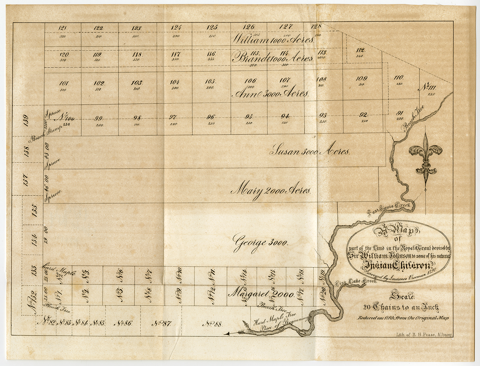
Antique print, titled: ‘Map of part of the land in the Royal Grant devised by Sir William Johnson to some of his natural Indian Children.’ – A map of the lands gifted to his children by Sir William Johnson, 1st Baronet. Part of these children were of Native American descent, as Sir William had relationships with both immigrant and native women. After the original map by Laurence Vrooman, 1797. This is a lithographically made map from ca. 1849. “Maps in the offices of Secr. Of State and Surveyor General”, Albany: Richard H. Pease, ca. 1850. Cartographers were David Vaughan, E.O. Olmsted and M.E. Seymour.Artists and Engravers: Made by ‘Richard H. Pease’ after ‘Laurence Vrooman’. Printer / publisher: Richard H. Pease (1813-1869) was an engraver / lithographer and printer from Albany.
Condition: Good, given age. Original folds as issued. Some faint soiling and some tiny stains. Top half of the sheet lightly browned. General age-related toning and/or occasional minor defects from handling. Please study scan carefully.
Keywords: ANTIQUE PRINT-ROYAL GRANT-WILLIAM JOHNSON-JOHNSTOWN-VROOMAN-PEASE
(PCO) C130-23

![GREATER SCAUP-AYTHYA MARILA-DUCK 'Anas marila' [SEPP and NOZEMAN, 1770]](https://pictura-prints.com/wp-content/uploads/2018/07/pcorc179-324x459.jpg)
![CCCCLXXV. Jordanes pallio divisus. [Johann SCHEUCHZER after HEUMANN, 1731]](https://pictura-prints.com/wp-content/uploads/2018/10/pcom-0723-e1540471616760-324x502.jpg)


Reviews
There are no reviews yet.