
Description
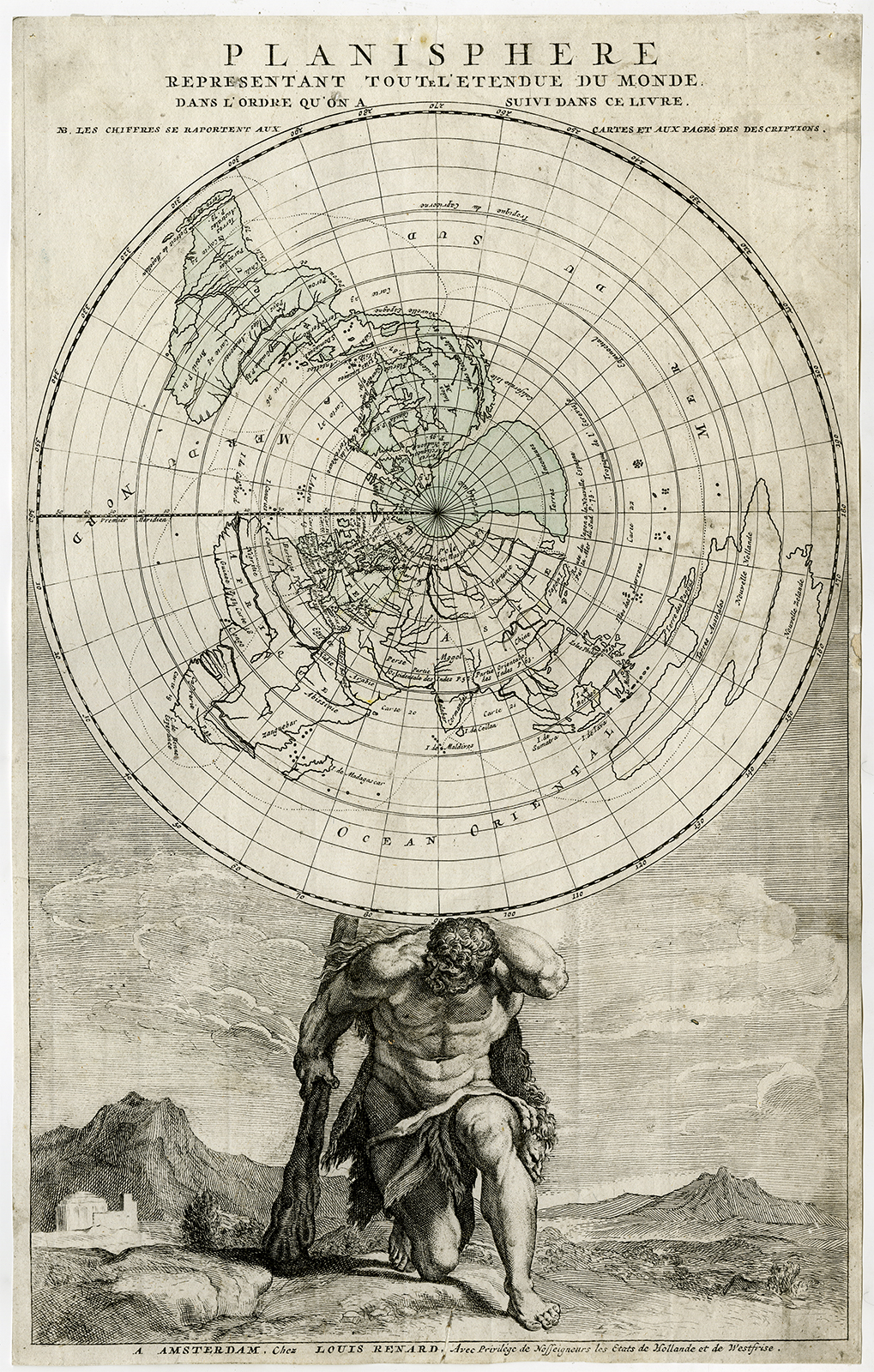
‘Planisphere representant toute l’etendue du monde […]’
etching / engraving with remains of colouring on hand laid (verge) paper.
Sheet size: 27,5 x 43,7 cm. (10,8 x 17,2 inch). Image size: 26,5 x 42,5 cm. (10,4 x 16,7 inch).
This is the first state of this map, published as a title engraving by Renard in 1715 and 1739 in “Atlas De La Navigation Et Du Commerce …”. State: First state (2). Ref: Koeman IV, Ren 1.
Anonymous.
Condition: Good, given age. Trimmed at the plate edge. Light soiling. Three small holes in top part, barely visible. Some false fold lines from printing. A few small stains. Some small paper loss in right paper edge, backed and not effecting image. General age-related toning and/or occasional minor defects from handling. Please study scan carefully.
Keywords: PLANISPHERE-WORLD MAP-HERCULES
RBOS-A1-21


Reviews
There are no reviews yet.