
Description
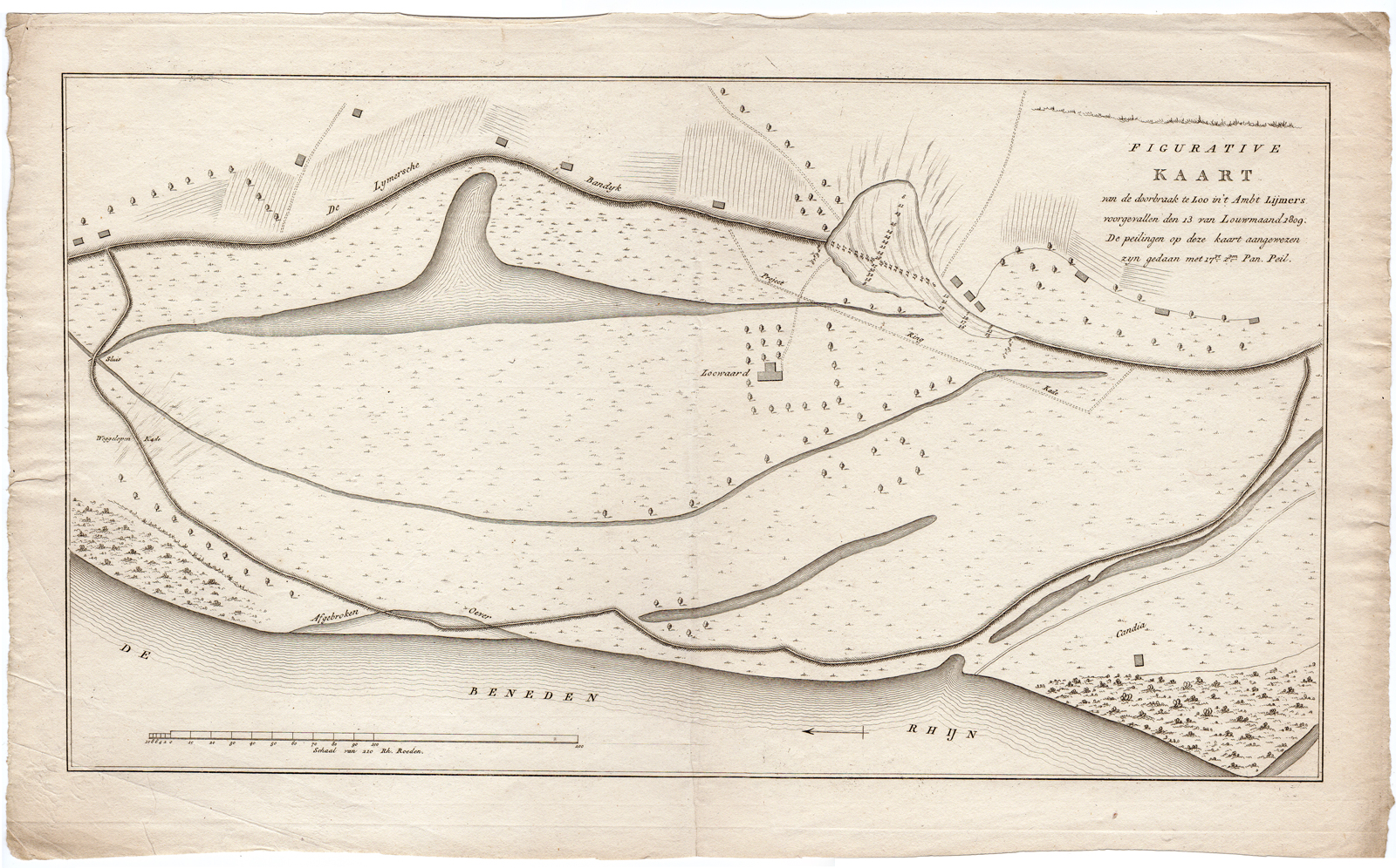
Subject: Antique print, titled: ”Figurative Kaart van de doorbraak te Loo in ”t Ambt Lijmers (…).” – This original antique map shows the dike breach of 1809 near Loo in the Liemers area, The Netherlands.
Condition: Good, given age. A few crinkles and creases. Original middle fold as issued. General age-related toning and/or occasional minor defects from handling. Please study scan carefully.
Medium: Copperplate engraving / etching on hand laid (verge) paper.
Size (in cm): The overall size is ca. 49 x 30 cm. The image size is ca. 45 x 25 cm.
Size (in inch): The overall size is ca. 19.3 x 11.8 inch. The image size is ca. 17.7 x 9.8 inch.
Part Number: 65030
Location: PCOM-B1-29
Description: From: ‘Geschiedkundig verslag der dijkbreuken en overstromingen langs de rivieren in het Koningrijk Holland voorgevallen in Louwmaand MDCCCIX.’ by H. Ewijk, published in Amsterdam by Joh. Allart and Jac. Ruys, 1809.
Artists and Engravers: Anonymous.


Reviews
There are no reviews yet.