
Description
Coloured engraving on vellin type paper. on paper.
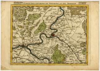
Size in cm: The overall size is ca. 33.4 x 23.6 cm. The image size is ca. 26.4 x 21.5 cm. Size in inch: The overall size is ca. 13.1 x 9.3 inch. The image size is ca. 10.4 x 8.5 inch.
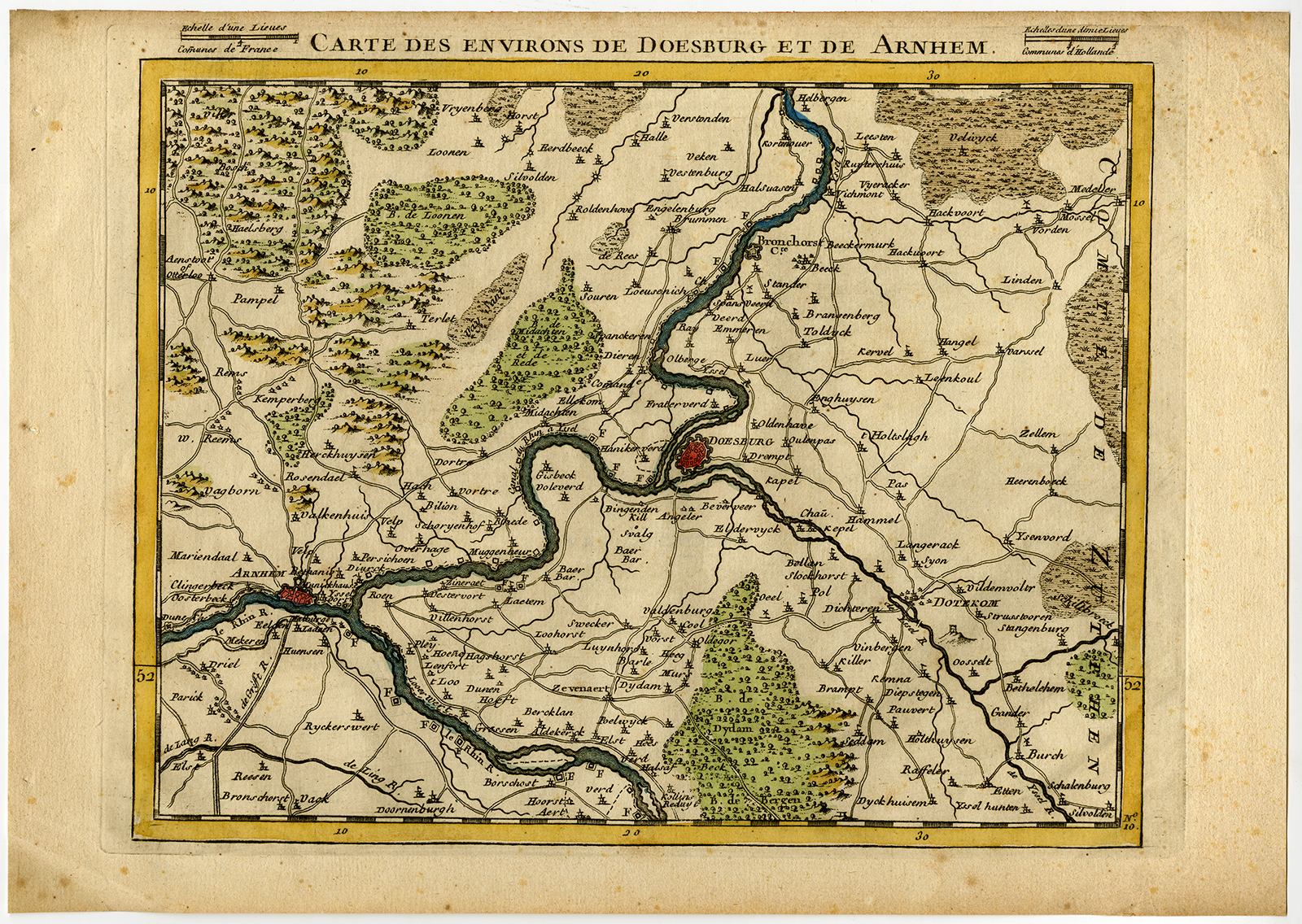
Antique print, titled: ‘Carte des environs de Doesburg et de Arnhem’ – Map of the area of Doesburg and Arnhem. From a series of 12 maps of The Netherlands, published 1740-1780.Artists and Engravers: Made by ‘Lerouge’ after ‘Georges Louis Le Rouge (Publisher)’. Georges Louis le Rouge (1707-1790) was a French military engineer, hydrographer and cartographer. He produced a wide rang of attractive cartographic work. He held a position of Geographical Engineer to King Louis XV.
Condition: Very good, given age. Small stains in margin. General age-related toning and/or occasional minor defects from handling. Please study scan carefully.
Keywords: ANTIQUE PRINT-DOESBURG-ARNHEM-NETHERLANDS-LE ROUGE-LEROUGE
XXX-A2-40
![FOOL-JESTER-LE GREFFIER FOL-L'ORY-PORTRAIT-P.214 'Le Grefier' [Lord GOWER after CLOUET, 1875]](https://pictura-prints.com/wp-content/uploads/2018/07/pcom439-324x431.jpg)


Reviews
There are no reviews yet.