


Description
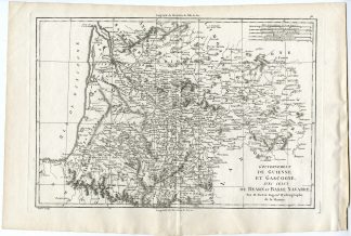
Original antique map that covers what is today’s Belgium between Dutch Brabant and France. When this map was drawn this area was united in what is today Holland under Napoleon and the French empire. Offers considerable detail with political divisions and color coding at the regional level.
Made by Samuel Neele after L. Herbert.
Medium: Engraving / etching with hand colouring on vellin paper.
Sheet size: 75 x 54 cm (29.53 x 21.26 inch). Image size: 69 x 50 cm. (27.17 x 19.69 inch).
Condition: good, given age. Tears in upper margin restored. Some wrinkles in the margins. General age-related toning and/or occasional minor defects from handling. Please study scan carefully.
BELGIUM-FRANCE-NETHERLANDS-HOLLAND | RBOS-T.30-LARGE
BACKGROUND INFORMATION
Published in Pinkertons Modern Atlas, London, 1810, by Cadell & Davies. John Pinkerton (1758-1820) was a Scottish writer, historian and cartographer.
Biography engraver: Samuel Neele, British engraver of views and maps (1758-1824).


Reviews
There are no reviews yet.