

 Print
Print Description
Engraving, hand coloured on hand laid paper. on paper.
Size in cm: The overall size is ca. 60.4 x 52 cm. The image size is ca. 58.2 x 51.3 cm. Size in inch: The overall size is ca. 23.8 x 20.5 inch. The image size is ca. 22.9 x 20.2 inch.
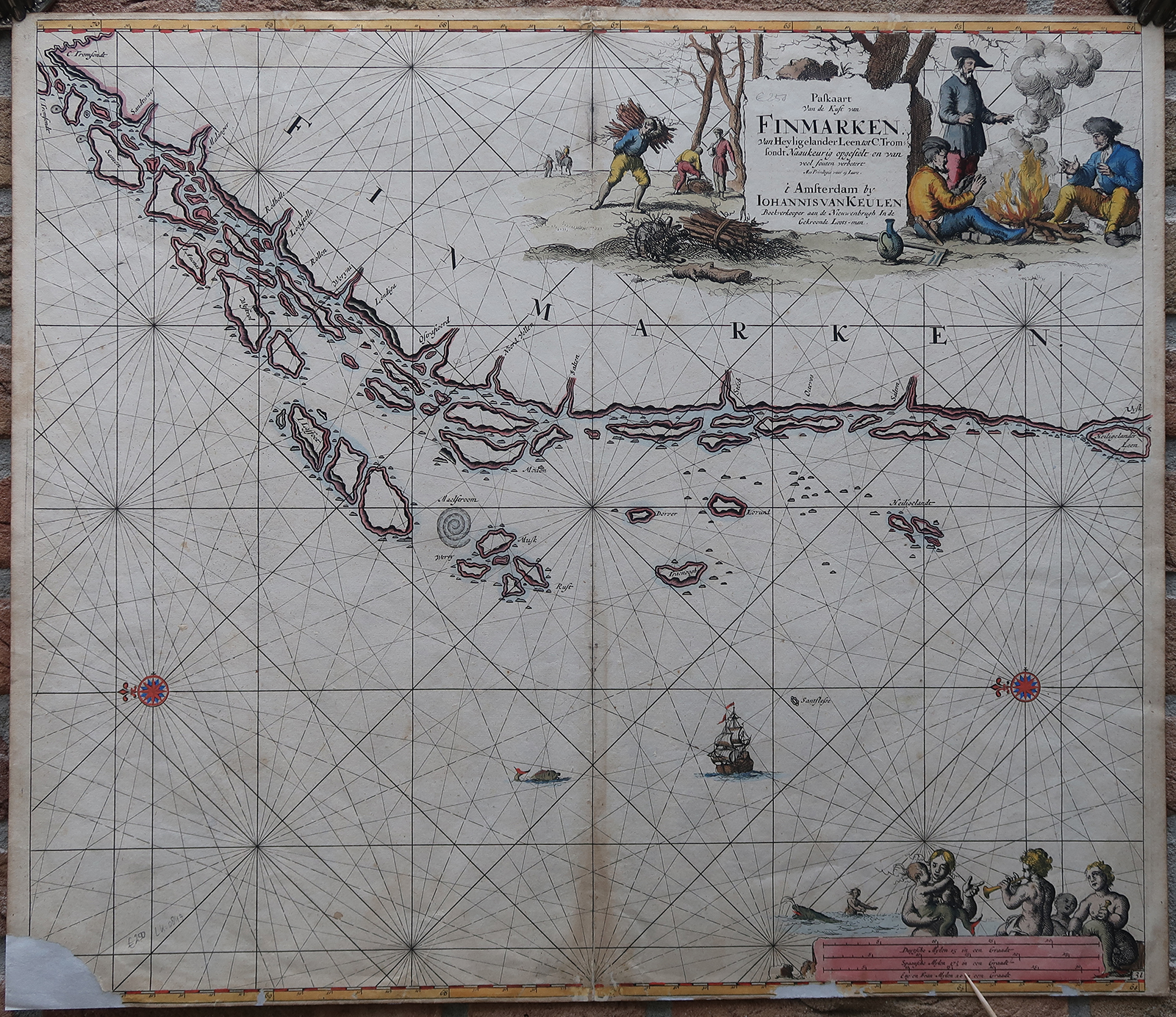
Antique map, titled: ”Paskaart van de Kust van Finmarken. Van Heyligelander Leen tot C. Tromsondt.” – Sea chart of the Norwegian coast, with Tromso in the far left edge. The location of a Maelstrom is depicted, Mokstraumen near the Lofoten archipelago. Rivers or Fjords are indicated along the coast. With two compass roses and rhumb lines. A decorative title cartouche in the top right with men gathering firewood or sitting around a fire. Sea monsters around the scale bars lower right. From “De Nieuwe Groote Ligtende Zee-Fakkel, ‘t Eerste Deel” edited by Claas Jansz. Voogt and Gerard van Keulen, originally published 1687-1706, but reprinted a few times until the end of the 18th century. We are not sure from which exact edition this map is.Artists and Engravers: Made by an anonymous engraver after ‘Johannes van Keulen’. Johannes van Keulen (1654-1711). The Dutch produced a remarkable number of enterprising and prolific map and chart makers but not even the Blaeu and Jansson establishments could rival the vigour of the van Keulen family whose business was founded in 1680 and continued under their name until 1823. The firm was founded by Johannes van Keulen who was registered as a bookseller in Amsterdam in 1678.
Condition: Very good, given age. Original middle fold, as issued. Small surface damages in the top edge. Paper loss and tears in the lower edge and lower left corner (backed). Lower middle fold browned. Some scattered small stains. General age-related toning and/or occasional minor defects from handling. Please study scan carefully.
Keywords: ANTIQUE MAP-SEA CHART-NORWAY-TROMSO-LOFOTEN-VAN KEULEN
(PCO) GK-245


Reviews
There are no reviews yet.