

 Print
Print Description
Engraving on hand laid paper. on paper.
Size in cm: The overall size is ca. 62.3 x 53.3 cm. The image size is ca. 57.7 x 50.2 cm. Size in inch: The overall size is ca. 24.5 x 21 inch. The image size is ca. 22.7 x 19.8 inch.
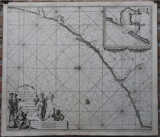
Antique map, titled: ‘Pascaert Van de Kust van Maroca beginnende van Larache tot aan C. Cantin.’ – A map of the coast of Morocco, from Larache to Cape Cantin. An inset map details Merja Zerga. The map has a very decorative cartouche with scale bars and five mythological figures, compass rose and rhumb lines as well as depth soundings along the coast. Published by Johannes van Keulen in Amsterdam, circa 1720.Artists and Engravers: Made by an anonymous engraver after ‘Johannes van Keulen’. Johannes van Keulen (1654-1711). The Dutch produced a remarkable number of enterprising and prolific map and chart makers but not even the Blaeu and Jansson establishments could rival the vigour of the van Keulen family whose business was founded in 1680 and continued under their name until 1823. The firm was founded by Johannes van Keulen who was registered as a bookseller in Amsterdam in 1678.
Condition: Very good, given age. Original middle fold, as issued. A few minor imperfections in the margins. Very nice impression. General age-related toning and/or occasional minor defects from handling. Please study scan carefully.
Keywords: ANTIQUE MAP-SEA CHART-MOROCCO-LARACHE-CAPE CANTIN-VAN KEULEN
(PCO) GK-348

Reviews
There are no reviews yet.