
Description
Engraving on hand laid paper. on paper.
Size in cm: The overall size is ca. 55.2 x 77.5 cm. The image size is ca. 48.2 x 66 cm. Size in inch: The overall size is ca. 21.7 x 30.5 inch. The image size is ca. 19 x 26 inch.
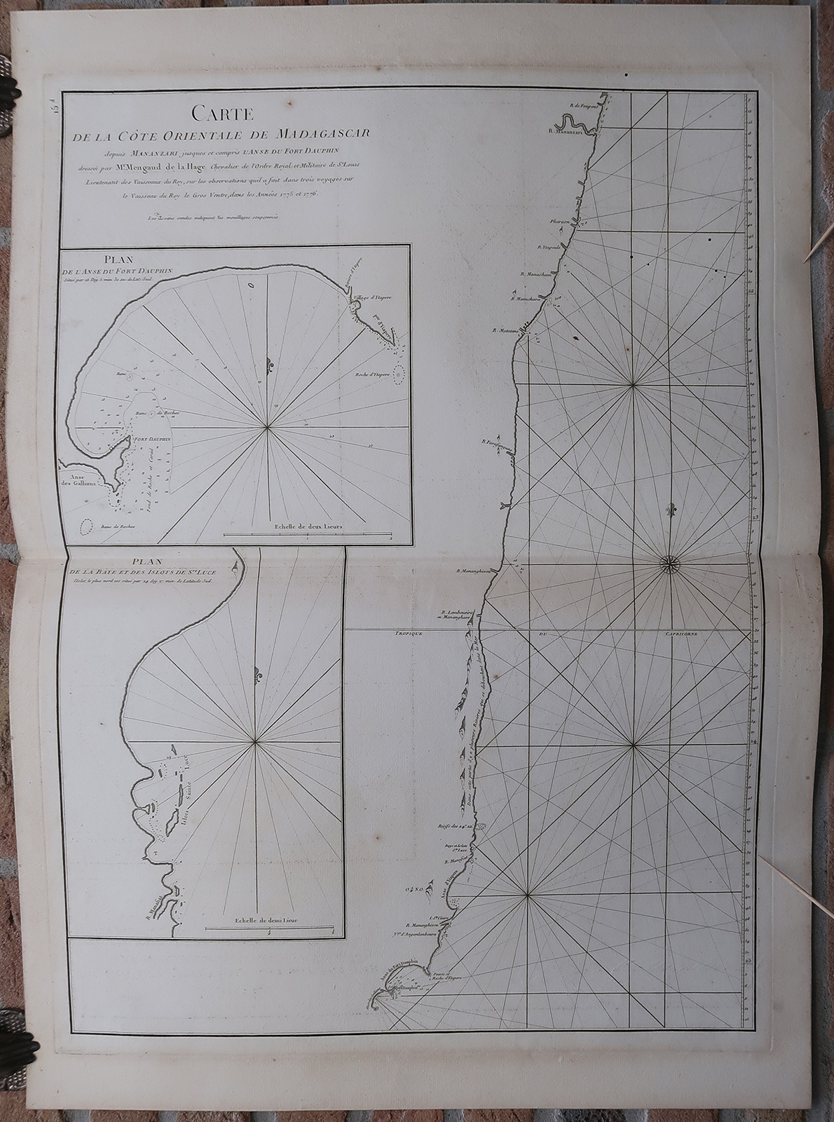
Antique map, titled: ”Carte de la Cote Orientale de Madagascar depuis Mananzari jusques et compris l”Anse du Fort Dauphin […].” – A coastal chart of Madagascar, from Mananjary South to Tolanaro (here named Fort Dauphin). Some places along the coast are named and a few geographical details are depicted. With rhumb lines and a compass rose. With an inset map of the bay near Fort Dauphin and another of the Bay of Saint-Luce. The map was published by Jean-Baptiste d’Apres de Mannevillette in ‘Neptune Oriental.’, in 1776.Artists and Engravers: Made by an anonymous engraver after ‘Mengaud de la Hage’. Jean-Baptiste-Nicolas-Denis d’Apres de Mannevillette (1707-1780) was a French hydrographer and cartographer.
Condition: Good, given age. Original middle fold, as issued. Browned in the margins. A crease in the top right margin corner. Some staining in the right margin. Small stains in the image area, and a few small wormholes. General age-related toning and/or occasional minor defects from handling. Please study scan carefully.
Keywords: ANTIQUE MAP-SEA CHART-MADAGASCAR-MANANJARY-TOLANARO-HAGE-MANNEVILLETTE
(PCO) GK-157
BE0


Reviews
There are no reviews yet.