


Description
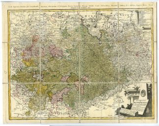
Medium: Engraving, hand-colored on hand-laid (verge) paper.
Sheet size: 59 x 46 cm (23.23 x 18.11 inch). Image size: 55 x 43 cm. (21.65 x 16.93 inch).
Condition: good, given age. Mounted on a linen-covered back sheet, squared cut-outs. Light soiling. General age-related toning and/or occasional minor defects from handling. Please study scan carefully.
SAXONY, GERMANY, 18TH-CENTURY MAP, HOMANN HEIRS, G?SSEFELD, ANTIQUE MAP, HISTORICAL CARTOGRAPHY, HOLY ROMAN EMPIRE | MAPS-FOREIGN
BACKGROUND INFORMATION
Published by Homann Heirs, 1783.
Reference: Leibniz-Institut f?r L?nderkunde (Leipzig).
Biography engraver: Franz Ludwig G?ssefeld (1744-1807) was a German cartographer associated with Homann Heirs, known for producing highly detailed and scientifically accurate maps of German territories.

Reviews
There are no reviews yet.