
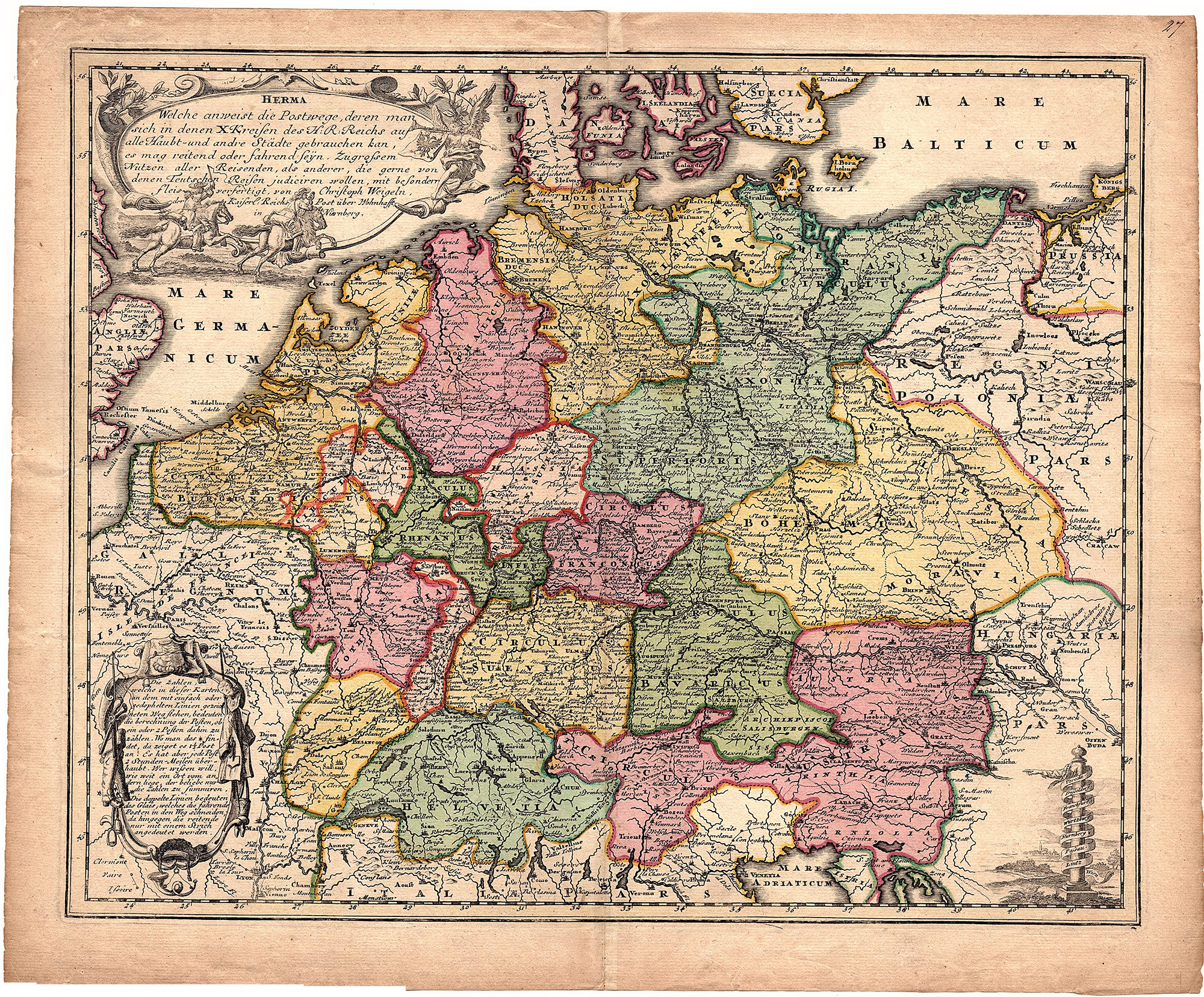
Description
This print shows a view on the map of Central-Europe which shows the postal roads in the 1700th.
Made by an anonymous engraver after Christoph Weigel.
Medium: Engraving on hand laid (verge) paper.
Sheet size: 44 x 36.5 cm (17.32 x 14.37 inch). Image size: 39.5 x 32.5 cm. (15.55 x 12.8 inch).
Condition: good, given age. Fold as published. Creases. Brown paper. Tear in upper margin restored. General age-related toning and/or occasional minor defects from handling. Please study scan carefully.
MAP-CENTRAL EUROPE-POSTAL ROADS-SWITSERLAND-GERMANY-NETHERLANDS | RBOS-A10-28
BACKGROUND INFORMATION
This print was published by Christoph Weigel, Nurenberg, Germany, 1718.
![PERSIA-IRAN-ALPHABET-ARABIC-LANGUAGE-TURKEY [After OLEARIUS, 1719]](https://pictura-prints.com/wp-content/uploads/2019/03/pcom-0685a-324x498.jpg)

Reviews
There are no reviews yet.