
 Print
Print Description
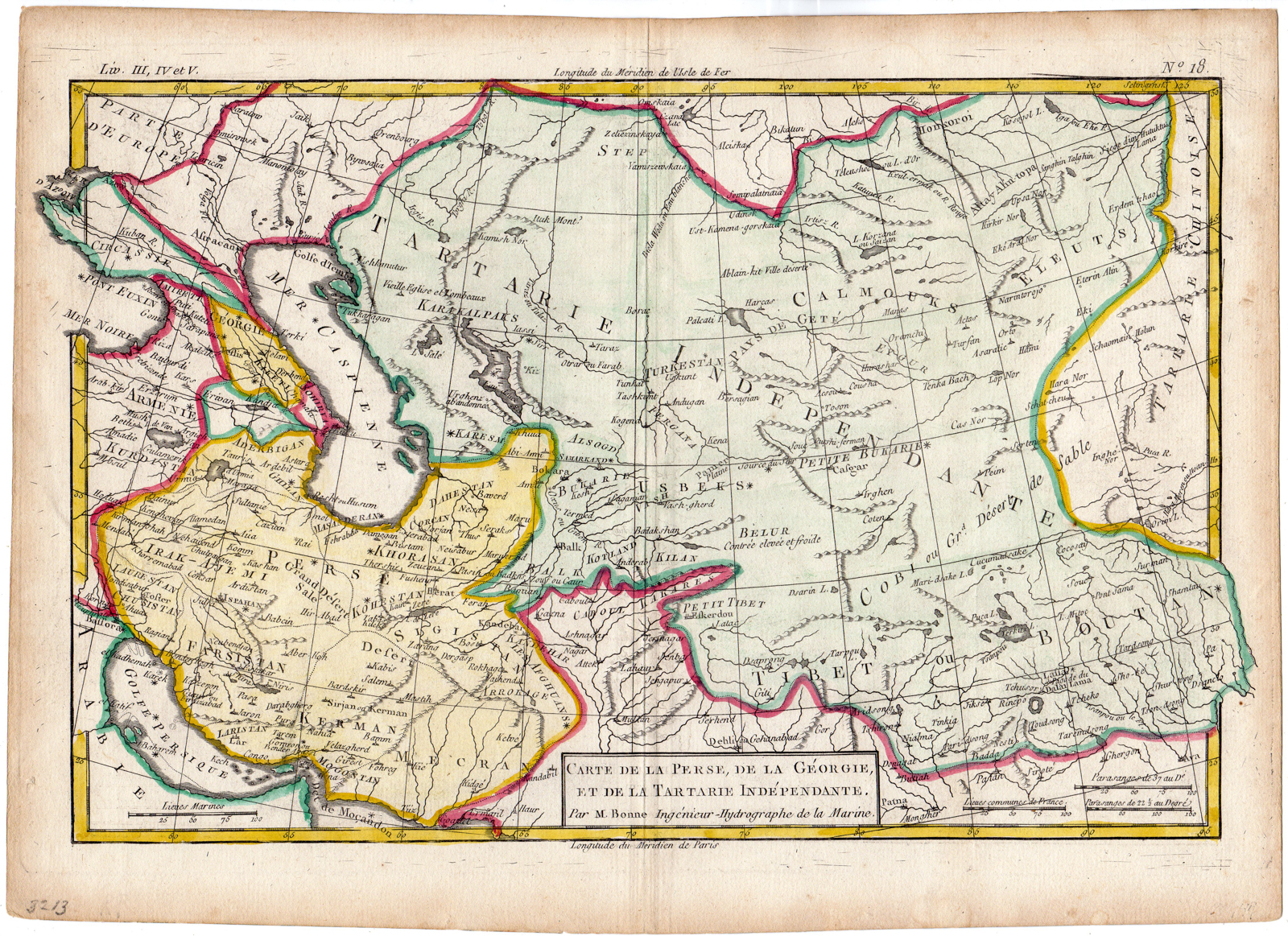
This handcoloured print shows a map of Persia, Iran, Georgia, Caspian Sea and parts of Tartary. Interesting and decorative antique map of Russia covering the area from the Caspian Sea across the Aral Sea with parts of Kazakhstan. Engraved place names, rivers, lakes and mountains.
Made by an anonymous engraver after Rigobert Bonne.
Medium: Engraving on hand laid (verge) paper.
Sheet size: 35.2 x 25.2 cm (13.86 x 9.92 inch). Image size: 32 x 21 cm. (12.6 x 8.27 inch).
Condition: good, given age. Fold as published. Brownish edges. Crease. General age-related toning and/or occasional minor defects from handling. Please study scan carefully.
MAP-IRAN-PERSIA-MIDDLE EAST-GEORGIA-CASPIAN SEA-KAZAKHSTAN-TARTARY | RBOS-A9-21
BACKGROUND INFORMATION
This attractive print was published by Rigobert Bonne in : ‘Atlas de toutes de parties connues du globes Terrestie (…), in Geneva, Swizerland, 1780.
Biography artist: Biography artist: Rigobert Bonne (1727-1794) was one of the most important French cartographers of the late 18th century. His son Charles-Marie Rigobert Bonne continued to publish his work until well after his death.


Reviews
There are no reviews yet.