
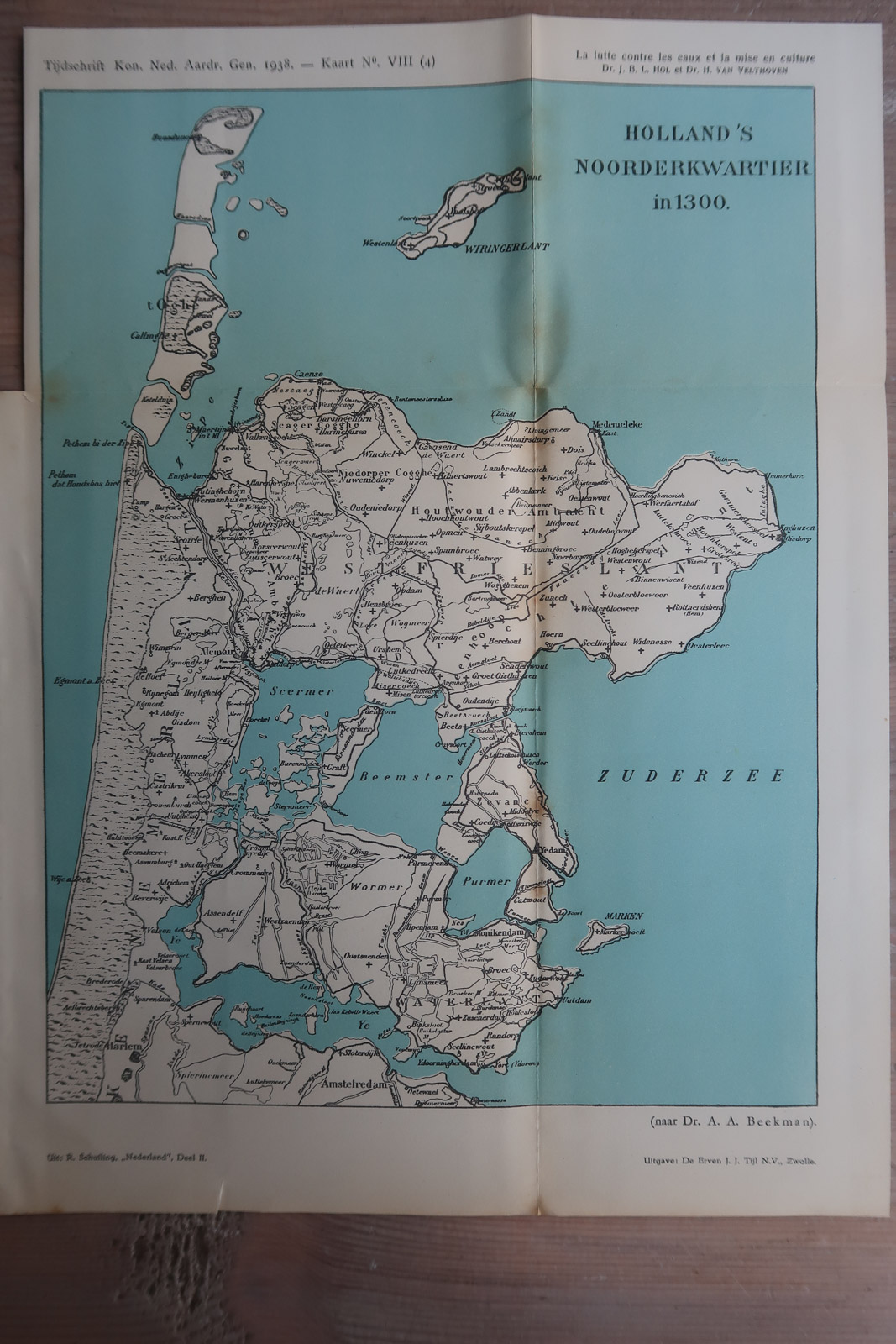
Description
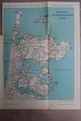
Map illustrating the northern part of Holland as it appeared in the year 1300, showint Westfriesland and various lakes that were later made into polders.
Made by an anonymous engraver after Dr. A.A. Beekman.
Medium: Lithograph on wove (vellin) paper.
Image size: 21.3 x 30 cm. (8.39 x 11.81 inch).
Condition: good, given age. Original folds as issued. Browning along folds. General age-related toning and/or occasional minor defects from handling. Please study scan carefully.
NOORDHOLLAND-WEST FRIESLAND | PCO-B5-19
BACKGROUND INFORMATION
Source: ‘Tijdschrift van het Koninklijk Nederlandsch Aardrijkskundig Genootschap’, a periodical published from 1888-1966, initially published by C.F. Stemler and later by Brinkman/Beijers (from 1879) and Brill (from 1894). This item dates from 1938.


Reviews
There are no reviews yet.