


Description
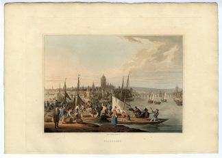
Medium: Copper engraving, hand-coloured on hand laid (verge) paper.
Sheet size: 50 x 38 cm (19.69 x 14.96 inch). Image size: 39 x 32.5 cm. (15.35 x 12.8 inch).
Condition: very good, given age. Old coloured copy, with wide margins and fold as issued. Verso: city description in German. General age-related toning and/or occasional minor defects from handling. Please study scan carefully.
NIJMEGEN, CITY MAP, HISTORICAL MAP, BRAUN HOGENBERG, CIVITATES ORBIS TERRARUM, 16TH CENTURY, NETHERLANDS, CITY MAP | MAPS-LARGE
BACKGROUND INFORMATION
Civitates Orbis Terrarum, Cologne, 1581, the first city atlas in the world. .
Reference: Van der Krogt 4, 2921: Nijm 1.
Biography engraver: Frans Hogenberg (1535-1590) was a Flemish-German engraver and mapmaker, known for his collaboration with Georg Braun on Civitates Orbis Terrarum, an important atlas of cityscapes.
Biography artist: Georg Braun (1541-1622) was a German geographer and editor-in-chief of the first large atlas of cityscapes, Civitates Orbis Terrarum, published in six volumes between 1572 and 1617.


Reviews
There are no reviews yet.