
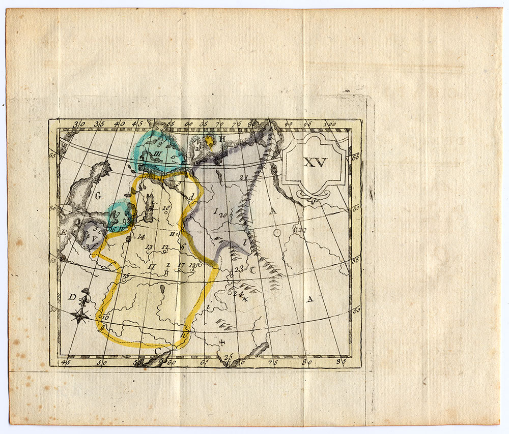
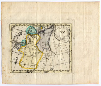
Description
Original hand-coloured engraving on a verge type handlaid paper. on paper.
Size in cm: The overall size is ca. 19 x 15.5 cm. The image size is ca. 12 x 9.5 cm. Size in inch: The overall size is ca. 7.5 x 6.1 inch. The image size is ca. 4.7 x 3.7 inch.
Map, number XV, titled: ‘De l’Empire de la Russie ou Moscovie.’ It shows: a map of the Muscovy empire, which contained large parts of modern-day Russia, the Baltic states and part of Finland. Corresponding text included. This map originates from “Atlas des Enfans, ou Nouvelle Methode pour apprendre la Geographie, avec un Nouveau Traite de la Sphere”, published in 1785 in Lyon by Bruyset. Although no author is given on the title page, J.H. Schneider is generally accepted as the author of this work. The first edition was published in 1760. The text, supplied with the corresponding map, explains the (otherwise unmarked) maps in the form of questions and answers, a well-known form for teaching books of the period.Artists and Engravers: Author: J.H. Schneider. Publisher: Jean-Marie Bruyset. Artist and engraver unknown.
Condition: Good, given age. Folds, as issued. Some stains in the left margin (not affecting image).General age-related toning and/or occasional light soiling from handling. Please study scan carefully.
Keywords: ANTIQUE MAP-MUSCOVY-RUSSIA-BALTIC-SCHNEIDER-BRUYSET
(PCO) C252-14

![CCCLXXVIII. Jothami Apologus. [Johann SCHEUCHZER after PINTZ, 1731]](https://pictura-prints.com/wp-content/uploads/2018/10/pcom-0758-e1540471967136-324x529.jpg)
![HERULES-HERULI TRIBE-WARRIOR-GERMANIC-GERMANY-P.4 [After FERRARIO, 1823]](https://pictura-prints.com/wp-content/uploads/2019/02/pco-2806-324x537.jpg)

Reviews
There are no reviews yet.