
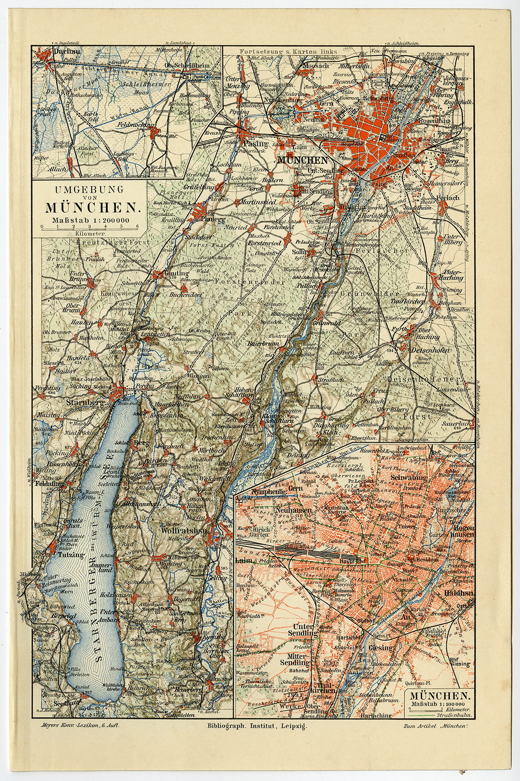
Description
Engraving on wove paper. on paper.
Size in cm: The overall size is ca. 16 x 24.3 cm. The image size is ca. 14.6 x 21.5 cm. Size in inch: The overall size is ca. 6.3 x 9.6 inch. The image size is ca. 5.7 x 8.5 inch.
Map: ‘Umgebung von Munchen.’ (Munich / Munchen and surroundings, Germany.) We carry slightly different maps from different editions. Please inquire. This attractive original old antique print / plate / map originates from 1885-1907 editions of a famous German encyclopedia: ‘Meyers grosses Konversations-Lexikon.’, published in Leipzig and Vienna. Meyers Konversations-Lexikon was a major German encyclopedia that existed in various editions from 1839 until 1984, when it merged with the Brockhaus encyclopedia. Several of the plates were also used in Dutch Encyclopedia’s like Winkler Prins.Artists and Engravers:
Condition: Excellent. Some small stains in margin. General age-related toning and occasional light stains from handling. Please study image carefully.
Keywords: ANTIQUE MAP-MUNCHEN-MUNICH-BAVARIA-GERMANY-MEYERS
(PCOMAN) A179-10
![Omnia ex te pendent [Johann SCHEUCHZER after PINTZ, 1731]](https://pictura-prints.com/wp-content/uploads/2018/10/pcom-624-324x472.jpg)

Reviews
There are no reviews yet.