
 Print
Print Description
Copperplate engraving on verge type hand laid paper with watermark. on paper.
Size in cm: The overall size is ca. 43 x 36 cm. The image size is ca. 41.5 x 35 cm. Size in inch: The overall size is ca. 16.9 x 14.2 inch. The image size is ca. 16.3 x 13.8 inch.
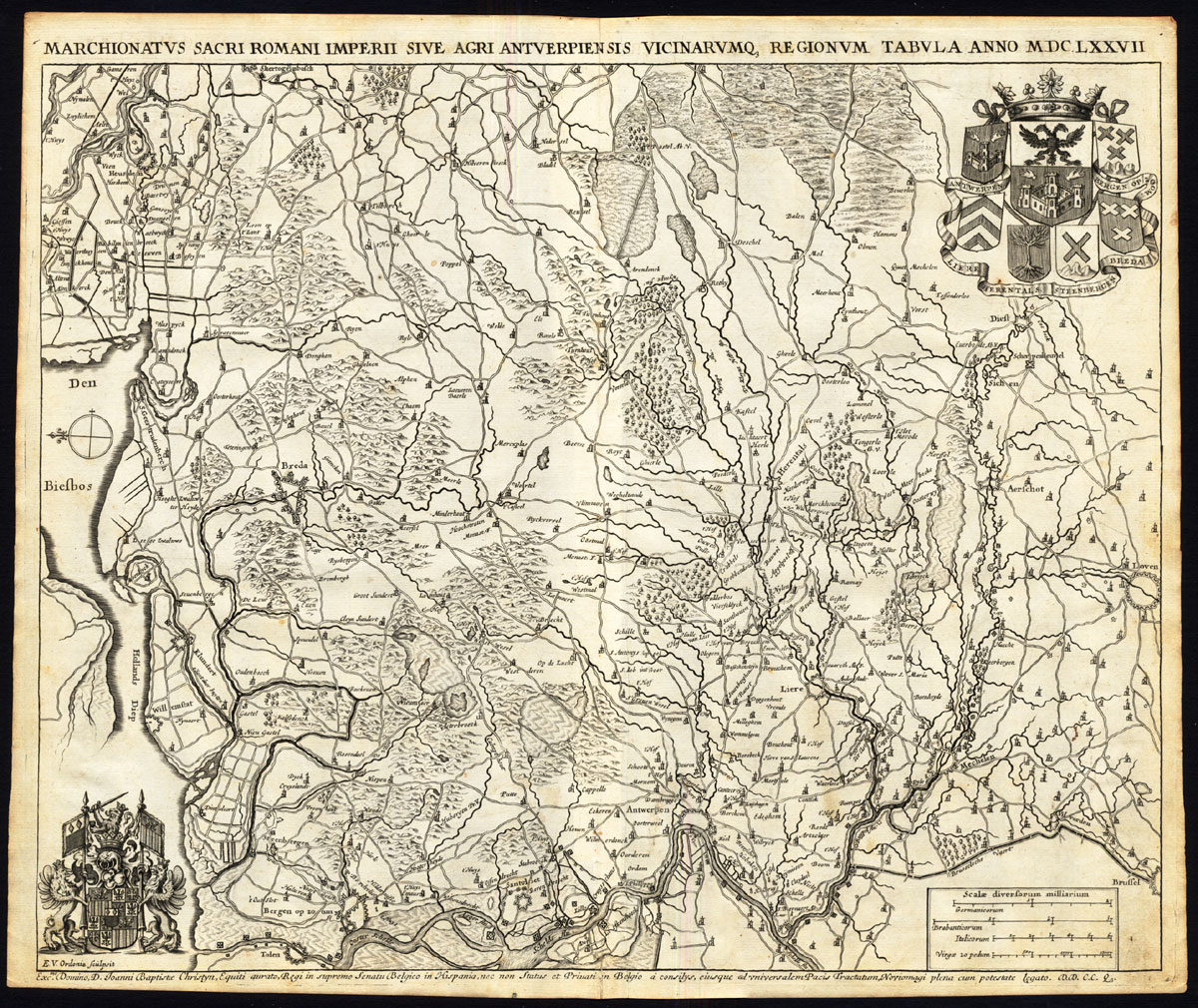
Marchionatus sacri romani imperii sive agri antverpiensis vicinarumq, regionum tabula anno MDCLXXVII.’ (Holy Roman, Imperial Margraviate of Antwerp and region anno 1677.) With coat of arms of Antwerp, Bergen op Zoom, Liere, Herenthals, Steenbergen and Bre This plate originates from: ‘Notitia Marchionatus Sacri Romani Imperii, Hoc est Urbis et Agri Antverpiensis, Oppidorum, Dominiorum, Monasteriorum, Castellorumque sub eo. (…).’ , by J. Le Roy, published by F. Lamminga, Amsterdam 1678. This is a chorographical description of the Margraviate of Antwerp, divided in 10 counties: Antwerp, Ryen, Zandhoven, Herentals, Geel, Hoogstraten, Turnhout and Breda. The plates were later used in other works by this author as well. Jacques Le Roy did extensive archival research, but he is reknown for his iconography for which he employed talented artists like Jacob Van Werden, Frans Ertinger, Wenzel Hollar, Lucas Vorsterman II and others. The engravers in this work include: Henricus Causé (1648-1699), Franz Ertinger (1640-1710), J.Harrewijn, Robert Whitehand, Bouttats, N.Stramot, G. De Bruyn. The imagery is highly reliable. His works were translated in several languages.Artists and Engravers: Author: Jacques Le Roy, also referred to as Jacob or Jacobus, was a Flemish baron, historian and theologian who lived from 1633-1719. This map engraved by Edouard Van Ordonie (1638-1695).
Condition: Excellent given it’s age. General age related toning and light staining. Narrow margins and middle fold as issued. Paper edges a bit irregular with very small tears. Paper separation at middle fold, backed. Please study scan.
Keywords: ANTIQUE MAP-MARGRAVIATE OF ANTWERP-BRABANT-BELGIUM-NETHERLANDS-LE ROY
(PCO) A85-02

![RUSSIA-MUSCOVY-FUNERAL CEREMONY-MOURNING [After DE MANDELSLO, 1719]](https://pictura-prints.com/wp-content/uploads/2019/03/pcom-0666-324x492.jpg)

Reviews
There are no reviews yet.