
Description
Copperplate engraving on verge type hand laid paper with watermark (not visible on every sheet). Recent hand coloring. on paper.
Size in cm: The overall size is ca. 41 x 29 cm. The image size is ca. 27.5 x 24 cm. Size in inch: The overall size is ca. 16.1 x 11.4 inch. The image size is ca. 10.8 x 9.4 inch.
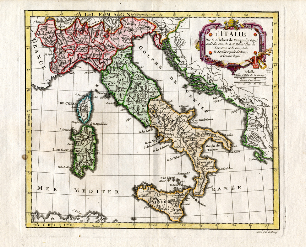
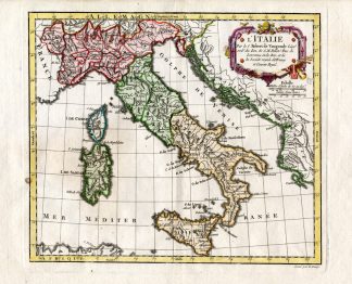
Title: ‘L’Italie’ (map showing all Italy and the islands Sicily, Sardine and Corsica) This map originates from: ‘Nouvel Atlas Portatif Nouvel Atlas Portatif, destiné principalement pour l’instruction de la jeunesse’, pas le S. Robert de Vaugondy Geographe ord du Roi, published in Pairs with Fortin in 1778.Artists and Engravers: Gilles Robert de Vaugondy (1688-1766), also known as Le Sieur or Monsieur Robert, and his son, Didier Robert de Vaugondy (c.1723-1786), were leading mapmakers in France during the 1700s.
Condition: Fine. General age related toning and light staining, particularly along the edges of the paper. Small rust spot in left margin as shown on image. Print is larger than shown on the scan. Carefully study scan as this shows the map well. Upper margin a bit narrow as issued.
Keywords: ANTIQUE MAP-ITALY-SICILY-SARDINIE-VAUGONDY
XXX-A1-34


Reviews
There are no reviews yet.