
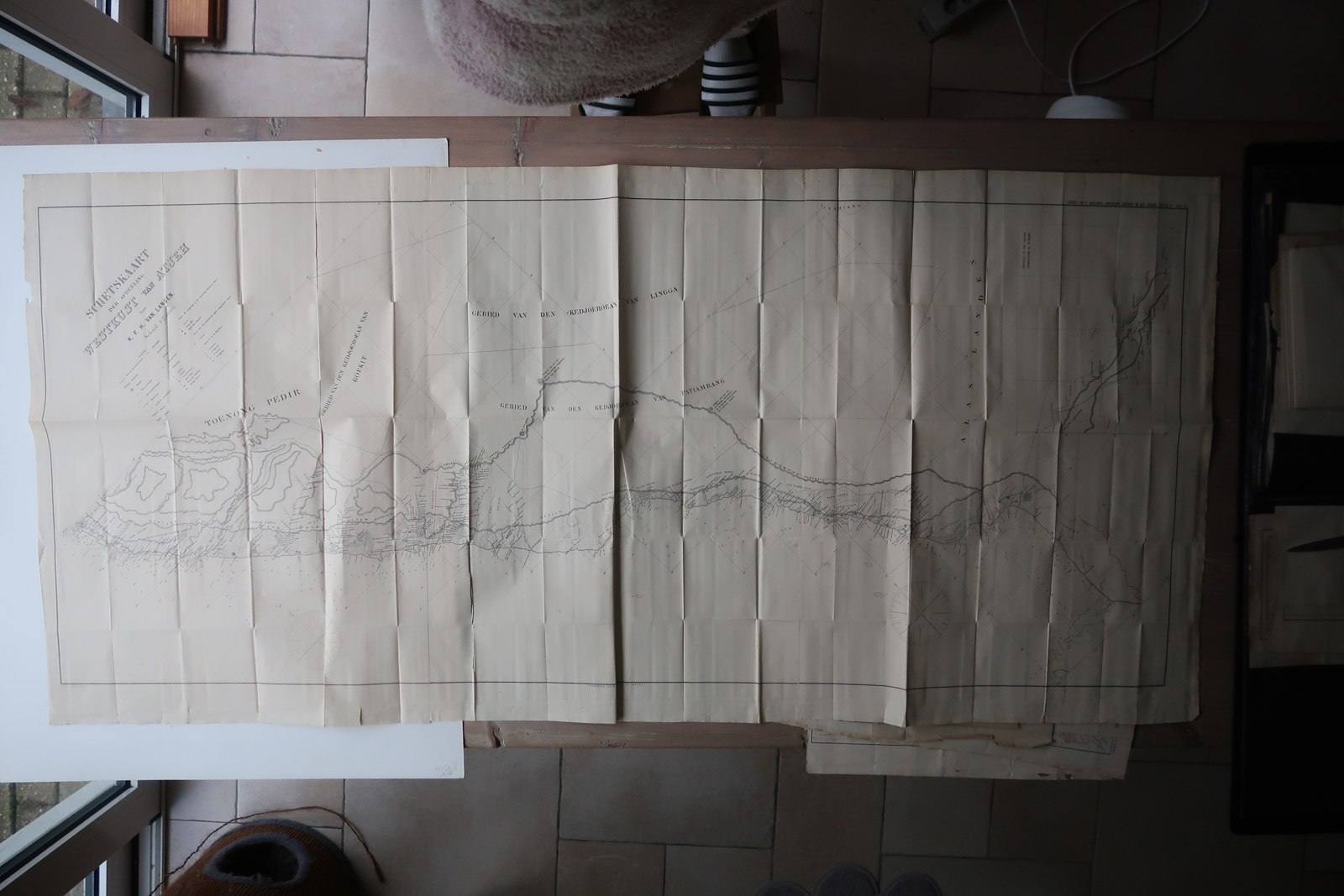
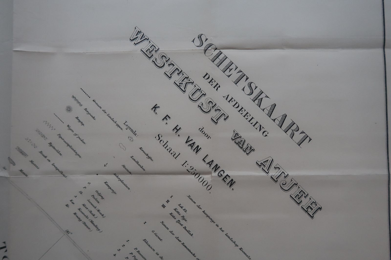
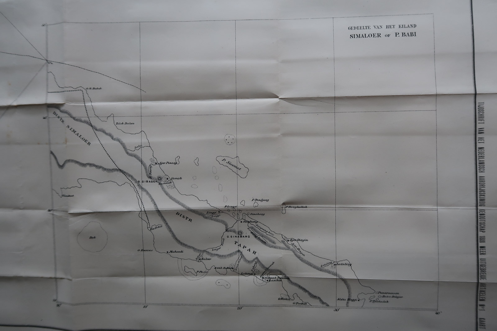

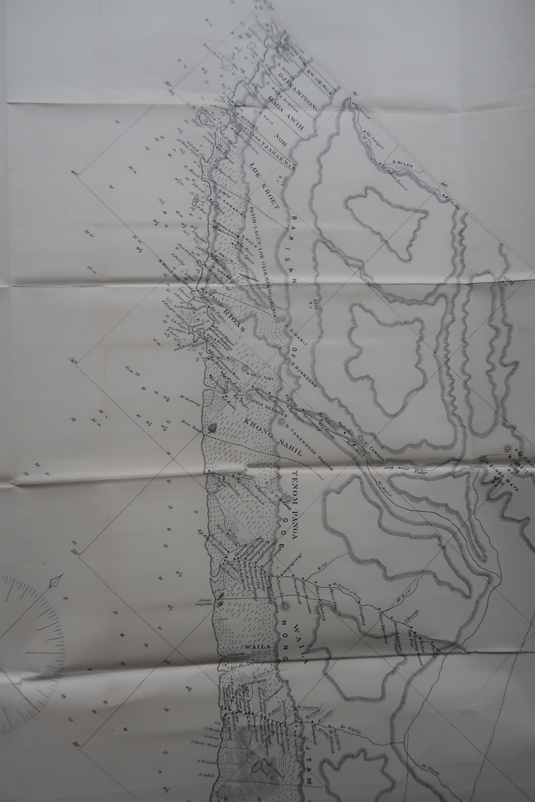

Description
Very large and detailed folding map of the west coast of Aceh, Sumatra, Indonesia. Inset map of Babi Island.
Made by an anonymous engraver after Aardr. Genootschap.
Medium: Lithograph on wove (vellin) paper.
Image size: 158 x 68.5 cm. (62.2 x 26.97 inch).
Condition: good, given age. Original folds as issued. Some foxing. Paper separation at folds. General age-related toning and/or occasional minor defects from handling. Please study scan carefully.
INDONESIA-SUMATRA-ACEH-BABI ISLAND | PCO-B5-32
BACKGROUND INFORMATION
Source: ‘Tijdschrift van het Koninklijk Nederlandsch Aardrijkskundig Genootschap’, a periodical published from 1888-1966, initially published by C.F. Stemler and later by Brinkman/Beijers (from 1879) and Brill (from 1891). This item dates from 1888.
. . Asia.
![COMMON SCOTER-DUCK-MELANITTA NIGRA 'Anas Nigra' [SEPP and NOZEMAN, 1770]](https://pictura-prints.com/wp-content/uploads/2018/07/pcorc228-324x461.jpg)


Reviews
There are no reviews yet.