


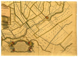
Description
Medium: Engraving with original hand-coloring on hand-laid (verge) paper.
Sheet size: 59.6 x 44 cm (23.46 x 17.32 inch).
Condition: good, given age. Light foxing, creasing and soiling. Several small tears in top paper edges. Overall browning. General age-related toning and/or occasional minor defects from handling. Please study scan carefully.
DUTCH HISTORICAL MAPS, 18TH-CENTURY CARTOGRAPHY, LAND SURVEY, NETHERLANDS, WATER MANAGEMENT, ANTIQUE MAPS, TOPOGRAPHICAL SURVEY, POLDER MAPS, NOBLE LANDOWNERS | MAPS-NETHERLANDS
BACKGROUND INFORMATION
Official land survey, Netherlands, 1746.

Reviews
There are no reviews yet.