
 Print
Print Description
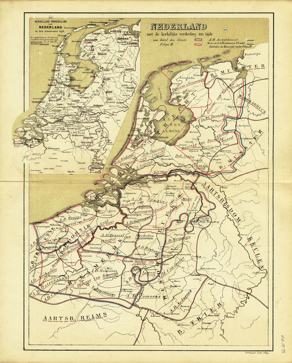
2 Tone colour lithograph with hand coloured border lines. on paper.
Size in cm: The overall size is ca. 29.5 x 37 cm. The image size is ca. 26 x 34 cm. Size in inch: The overall size is ca. 11.6 x 14.6 inch. The image size is ca. 10.2 x 13.4 inch.
Map : ‘Nederland met de Kerkelijke verdeeling ten tijde van Karel den Groote en Filips II.’ (The Netherlands with the religious division at the time of Charlemagne and Philip II of Spain). With an inset map of the religious division in ca. 1875. This original antique map originates from: ‘Historisch-Geographische Atlas der Algemeene en Vaderlandsche Geschiedenis’ (Historic Geographic Atlas of the general and Dutch history) by W. Huberts, published in Zwolle, The Netherlands in 1877.Artists and Engravers: W. Huberts, author. W. B. Kuijpers, lithographer.
Condition: Fine. General age related toning and soiling. Slightly foxed mainly in the margins, not effecting image. A few small tears in the margins and middle fold, backed. Please study scan carefully.
Keywords: ANTIQUE MAP-HISTORIC MAP OF THE NETHERLANDS-RELIGION-CHARLEMAGNE-HUBERTS
(PCO) A223-15

Reviews
There are no reviews yet.