


Description
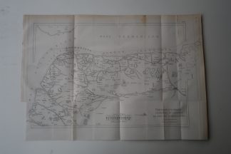
Map of the nomenclature and geography at the coast and region near present day Gravelines / Grevelingen as it was in the year 800 under Emperor Charlemagne.
Made by Anonymous after Revue Maritime.
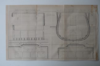
Medium: Etching / Engraving on wove (vellin) paper.
Sheet size: 44 x 27 cm (17.32 x 10.63 inch).
Condition: good, given age. Original folds as issued. Foxing, which can be removed on request. General age-related toning and/or occasional minor defects from handling. Please study scan carefully.
GRAVELINES-GREVELINGEN REGION IN THE YEAR 801 | PCO-B5-01
BACKGROUND INFORMATION
From ‘Revue Maritime et Coloniale’, a periodical published in Paris from 1861-1896 by the French ‘Ministere de la Marine et des Colonies’. This item was published in 1869.

Reviews
There are no reviews yet.